ArcGis Online
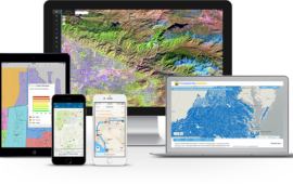
The Mapping Platform for your organisation. Users in your organisation can create and share maps throughout your organization, and access critical location information from your desktop, browser, tablet, or smartphone-anytime, anywhere.
ArcGIS for Server Features at a glance
Ready-to-Use-Apps.
Security
Try ArcGIS
Try ArcGIS
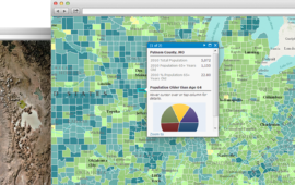
Ready-to-Use-Maps
Secure and Trustworthy
Secure and Trustworthy

ArcGIS Solutions
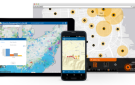
Tools for developers
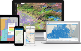
Tools for developers
Customized solutions
We help businesses of all sizes to increase visibility, drive more traffic and improve commercial success
The Mapping Platform for Your Organization
ArcGIS Online gives you everything you need to create interactive web maps and apps that you can share with anyone. It provides users ….
- With ready-to-use content
- Create project groups
- Customize work tools
- Build your own web apps
- Templates
- Base Maps
- Combine your data with data from Esri
- Users can access maps and information on any device, anytime, anywhere!
ArcGIS Online gives you everything you need to create interactive web maps and comes with ready-to-use productivity apps, content, and templates. Information collected in the field can easily be integrated on the GIS platform.
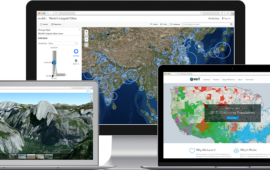
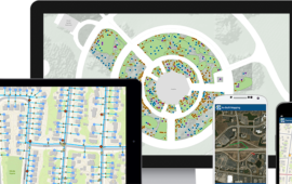
The users can monitor activities, events, and assets through interactive dashboards. information can be shared with anyone, anytime, anywhere on their devices—desktops, browsers, smartphones, or tablets.
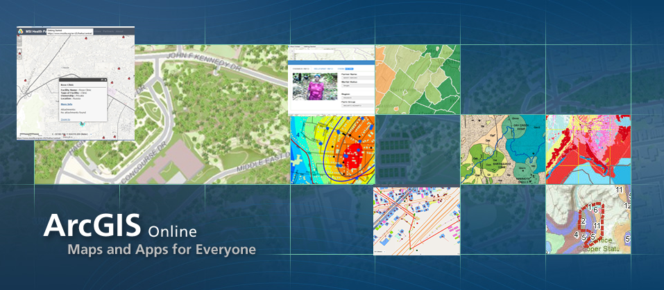
ArcGIS Online is a collaborative, cloud-based platform that allows members of an organization to use, create, and share maps, scenes, apps, and data, and access authoritative basemaps and ready-to-use apps.
ArcGIS Online gives you everything you need to create interactive web maps and comes with ready-to-use productivity apps, content, and templates. Information collected in the field can easily be integrated on the GIS platform ready-to-use apps.
ArcGIS Includes Online Content and Capabilities
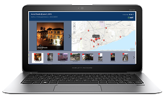
ArcGIS Online map showing floods in Accra_Ghana
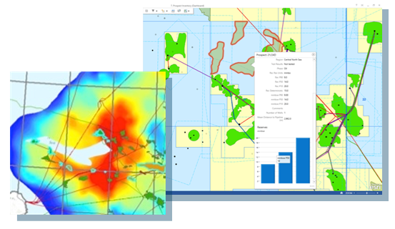
Dashboard Analysis on ArcGIS Online
Regardless of how you interact with the ArcGIS system, you can use its online capabilities to collaborate and share results with colleagues, stakeholders, or the public.
Create maps on ArcGIS for Desktop and publish them to ArcGIS Online so others using the ArcGIS system can leverage them. Also bring information that others have shared via ArcGIS Online into your ArcGIS for Desktop projects.
Browser—Use ArcGIS Online in a number of ways:
- Using ArcGIS Explorer Online, you can bring information that others have shared into your projects. You can also create mashups from shared services and, in turn, share the new maps you create.
- Using simple Web apps built with the ArcGIS system, you can access ArcGIS Online content.
- Using arcgis.com, you can browse maps and apps published to ArcGIS Online by others using the ArcGIS system, and create your own maps that you can share.
Mobile—Use ArcPad, ArcGIS for Windows Mobile, and ArcGIS for iOS to access maps shared to ArcGIS Online.
Developer tools—Build Web apps or mobile apps that leverage ArcGIS Online map and task services.
ArcGIS Online at No Extra Cost
ArcGIS Online is a part of an ArcGIS for Desktop license. For each ArcGIS for Desktop license that is current on maintenance, one named user account and 100 service credits will be issued. Take full advantage of ArcGIS Online without ever leaving your desktop applications. Import basemaps, search for data or features, and share information with individuals or groups from a convenient, centralized location.
ArcGIS Online Entitlements
Customers with current ArcGIS for Desktop licenses are entitled to be part of an ArcGIS Online Organization Plan account.
Alternatively, if you have Portal for ArcGIS, current ArcGIS for Desktop licenses are entitled to be part of an instance.
Every eligible ArcGIS for Desktop license receives one Named User account. You’ll be asked to choose whether you want your ArcGIS for Desktop License Entitlements applied to an ArcGIS Online Organization Plan account or Portal for ArcGIS instance.
Applies to the Following Customers:
- ArcGIS for Desktop – Perpetual Use Licenses current on maintenance
- ArcGIS for Home Use Program – current Term License
- Esri ELA Home Use Program – current Term License
- Small Landscape Architecture and Urban Design Bundle – ArcGIS for Desktop – current Term License or Perpetual Use Licenses current on maintenance
- Esri Nonprofit Organization ArcGIS for Desktop – current Term License
What Do You Get?
- One Named User per ArcGIS for Desktop license
- 100 Service Credits per ArcGIS for Desktop license
How to Access Entitlements
Contact our sales team sales@sambusgeospatial.com, technical@sambusgeospatial.com
Supported HTML
You can use HTML in the ArcGIS Online website when a rich text editor is included such as in the organization description and banner, item details, group descriptions, map pop-ups, and configurable apps.
HTML tags and attributes
In the table is the list of the supported HTML tags and attributes you can use.
| Tag |
Attribute |
| a | href, target, style |
| img | src, width, height, border, alt, style |
| video | autoplay, controls, height, loop, muted, poster, preload, src, width |
| audio | autoplay, controls, loop, muted, preload, src |
| span | style |
| table | width, height, cellpadding, cellspacing, border, style |
| div | style, class |
| font | size, color, style |
| tr | height, valign, align, style |
| td, th | height, width, valign, align, colspan, rowspan, nowrap, style |
| b, strong, i, em, br, p, li, ul, tbody |
Organization Banner
The home page includes a banner at the top of the page that is 960 pixels wide by 180 pixels high. You can select an image for the banner area, choosing a predefined image or uploading a file from your desktop, or you can create a custom design using rich text or HTML. Configure the banner as part of the home page settings.
If you choose the Custom design option, you’ll see a rich text editor where you can position graphics and text in a what you see is what you get (WYSIWYG) format. Delete the existing banner content and replace it with your own. For further flexibility, click the View HTML Source button in the editor, which allows you to type or paste your own HTML code.
If you just select an image for your banner, your logo appears within the banner image. If you use the custom design for your home page banner, the logo does not appear (unless you include it in your design).
Organization roles
A role defines the privileges that a member has within the organization. Esri defines a set of privileges for the User, Publisher, and Administrator roles. In addition, organizations can define privileges at a more detailed level by creating and assigning custom roles.
Role privileges
|
Privilege |
User |
Publisher |
Administrator |
Custom |
| Use maps and apps | √ | √ | √ | √ |
| `1qCreate content | √ | √ | √ | Optional |
| Share maps and apps | √ | √ | √ | Optional |
| Join and create groups | √ | √ | √ | Optional |
| Edit features | √ | √ | √ | Optional |
| Publish hosted web layers | √ | √ | Optional | |
| Perform analysis | √ | √ | Optional | |
| Manage Open Data sites | √ | Optional | ||
| Invite users to organization | √ | Optional | ||
| Manage organization resources | √ | Optional | ||
| View subscription status | √ | Optional | ||
| Configure website | √ | |||
| Create custom roles | √ | |||
| ArcGIS Marketplace provider (requires organization authorization) | √ |
Custom roles
Organizations might want to refine the standard roles into a more fine-grained set of privileges. For example, members who work with the organization’s private maps and apps but do not have a need to create content can be added to the organization in a custom-defined viewer role. In addition, some administrative tasks such as inviting users or managing content can be designated to members through a custom role. There may be cases where members need to have the Esri-defined Administrator role instead of a custom role. For example, only Administrators can configure the website and create custom roles. Administrators configure custom roles based on any combination of the general and administrative privileges listed below. Additional functionality will be added in the future. Check with your Administrator for the specific privileges in your organization’s custom roles.
General privileges
Members who perform specific tasks within the organization—create maps or edit features, for example—can have custom roles that give them the general privileges they need to work and share with groups, content, and features.
- Create, update, and delete groups
- Join organizational groups
- Join external groups
- Create, update, and delete content
- Publish hosted feature layers
- Publish hosted tile layers
- Share with groups
- Share with organization
- Share with public
- Make groups visible to organization
- Make groups visible to public
- Make groups available to open data sites
- Use Esri World Geocoder to convert addresses to map points (geocoding) such as when publishing a CSV of addresses as hosted feature layers or adding a CSV of addresses to a map. Does not apply to custom geocoders configured for the organization.
- Perform network analysis tasks such as create drive-time areas
- Perform spatial analysis tasks such as create buffers
- Use GeoEnrichment to enrich features
- Use Esri demographic map layers that require credits
- Perform elevation analysis tasks on elevation data
- Edit features based on permissions set on the layer.
- Edit features with full control on editable hosted feature layers.
- Manage open data sites
Administrative privileges
Your organization might want to create roles for managing the members, groups, or content of the organization. These custom administrative roles do not contain the full set of privileges of the Administrator.
- View all member account info
- Update member account info
- Delete member from the organization (only Administrators can delete other Administrators)
- Invite members to organization
- Disable member from the organization
- Change roles of members (only Administrators can change the role to and from Administrator)
- Manage licenses for members
- View group owned by member
- Update group owned by member
- Delete group owned by member
- Reassign ownership of groups
- Add member to groups
- View content owned by member
- Update content owned by member
- Delete content owned by member
- Reassign ownership of content
- Request purchases in ArcGIS Marketplace
- Start trials in ArcGIS Marketplace
Privileges for common workflows
Some workflows require a combination of privileges. If you cannot perform a function that you think your role should be able to do, verify that your Administrator has enabled the full set of required privileges.
Privileges for common workflows
Some workflows require a combination of privileges. If you cannot perform a function that you think your role should be able to do, verify that your Administrator has enabled the full set of required privileges.
| In order to… |
You need privileges to…. |
| Use the analysis tools | Create content, publish features, and use spatial analysis. Some tools require privileges to use GeoEnrichment or network analysis. |
| Publish hosted feature layers | Create content, publish hosted feature layers, and use geocoding (to publish CSV with addresses). |
| Publish hosted tile layers | Create content and publish hosted tile layers. |
| Publish apps from the map viewer or group page | Create content and share items (with groups, organization, or public). |
| Embed maps or groups | Create content and share items with public. |
| Manage content owned by members | View all member account info, view content, update content, delete content, and reassign content. |
| Manage groups owned by members | View all member account info, view group, update group, reassign group, delete group, and add member to group. |
| Manage member profiles | View all member account info and update member account info. |
| Make groups available to Open Data sites | Make groups visible to public and make groups available to Open Data. |
| View subscription status | View all member account info, view all content, and view all groups. |
| Add, update, and delete features in hosted feature layers that have editing enabled for add or update only | Edit features and edit with full control. |
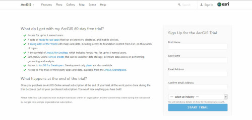
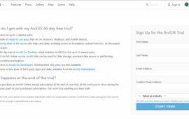
Get ArcGIS 60-day free trial.
Once you purchase an ArcGIS Online annual subscription at the end of your trial, all the work you’ve done during the trial becomes part of your purchased subscription. You won’t lose anything you have built!