Can building collapse be AVOIDED? Find out here.
INTRODUCTION
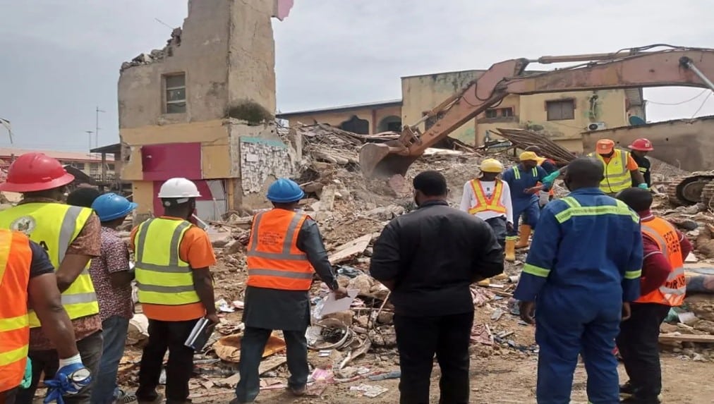
At exactly 11pm on the 24th of August 2023, yet another building went down in Lagos Street in Abuja, the Capital city of Nigeria. This incident followed a trail of building collapses occurring in several cities across the country over the past years and further highlighted the need for measures to curb this deadly menace.
The Building Collapse Prevention Guild recorded at least 62 catastrophes in 2022, causing 84 deaths and injuring 113 persons. Lagos had 20 cases, while Kano and Anambra recorded five building accidents each, and Delta and Jigawa four each. Also, 135 cases were reported between 2007 and 2013. According to The PUNCH there has been 115 incidents in Nigeria between 2012 and 2022.
In light of the environmental change being experienced and a variety of factors that can affect the integrity of buildings, building safety has become more important as buildings become susceptible.
Popular Incidents in recent years:
- In September 2014, the multi-storey guesthouse of the Synagogue Church of all Nations collapsed, killing 116 people, including foreigners.
- In March 2016, 35 persons died when another structure in Lekki Gardens collapsed.
- In November 2021, a 21-one-storey building located at No 44 Gerard Road, Ikoyi, not far from the present site, killing over 40 site workers.
- In May 2022, a three-storey building collapsed in Ebute-Meta, claiming at least eight lives.
- Lagos again, recorded another incidence of collapsed building at First Avenue, Banana Island, Ikoyi, on Wednesday April 12, 2023 when a seven-storey mansion under construction caved for a yet to be identified reason.
Why do buildings Collapse?
- Poor structural design
- Poor compliance with specifications
- Poor quality control
- Faulty construction methodology
- Foundation failure
- Corruption
So, can building collapse be avoided? The answer is yes. How?
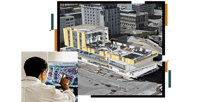
INCORPORATING GIS TO REDUCE BUILDING COLLAPSE
By using GIS in the planning, construction, and post construction phases, building safety can be better modeled and understood. The following highlights ways to do this.
- Using GIS to Find Safe Building Sites
This is known as determining site suitability. It is a study on choosing building sites and using GIS in hilly areas. It was demonstrated that GIS can be effective for finding safe building sites. In particular, the approach demonstrates that modeling the location and topographical qualities together help to determine how safe a building is in a particular location. This GIS framework integrates a variety of safety-related but also cultural and other data to help planners make better choices for building sites. In this case, the building framework incorporates digital elevation modeling, geologic mapping, geomorphology, natural hazards, heritage/archaeological sites, military areas, oil fields, and soils to identify areas where building sites could be more suitable.
Slope and aspect data were found to help determine which areas are relatively more suitable. The study demonstrated that using GIS can supplement traditional, computer-aided design (CAD) by helping to make better choice regarding building location, identifying better areas of suitability.
- models that help identify potential weak points or vulnerable areas of a building and building site.
Workflows in BIM and GIS integration include:
- Flood analysis to find the best location or structure of a facility/asset.
- Shadow analysis to verify duration of lightning for solar potential or healthy living conditions.
- In the context of urban development, a line-of-sight analysis can make sure relevant sight axis are kept.
- Understanding material flow for sustainable or circular design/development.
- Modeling on-site staff requirements to maximize safety, equity, and productivity.
Placing a BIM model into real-world context ensures that stakeholders understand any issues or hazards that may arise during a project because the information is easily accessible and understandable. This may reveal risk and security management problems early or help with cost reductions and scheduling.
One area of research is modeling more extreme environments, including environmental hazards, to ensure that buildings can be safely built in a given area.
Conclusion
GIS and building safety has proven to be inseparable. For a more holistic planning and maintenance of building structure, the geographical location and implications must be considered. Integration of GIS in BIM also means building projects can have a digital twin and fatal errors can be easily detected and corrected in the digital twin before it is made on the ground. This is useful to avoid collapse of buildings during the construction phase. For sustainable and resilient infrastructure, be sure to explore the advantages GIS provides.