Mapping a Nature-Based Solution to Human-Elephant Conflict
An ancient African folktale tells of elephants that are afraid of honeybees. In 2006, researchers proved that tiny insects can indeed affect—and help save—the world’s largest land mammal.
Lucy King, head of the Elephants and Bees Project for Kenya-based Save the Elephants, had the idea to play recordings of swarming African honeybees near elephant herds and saw how the huge animals quickly run away. Her findings are the foundation of a creative solution that saves elephants’ lives by using beehives to redirect elephants before they interact with humans.
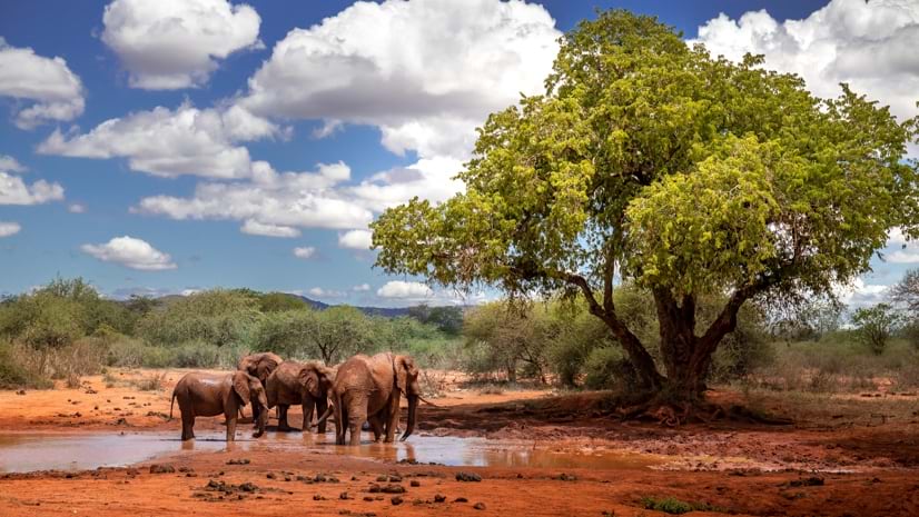
In Kenya, the majority of wildlife live outside protected areas. Elephants can become a nuisance for farmers, who suffer devastating crop raids when the hungry giants trample their fields, often at night. The two come into conflict—farmers want to protect their livelihoods, homes, and families and elephants want to provide for their herds.
King and her team developed a nature-based solution—beehive fences made of wire and treated poles with beehives hanging between them. When elephants strike the fence wires, bees come out buzzing, which scares the elephants away. The team worked with farmers to install them around their fields. Farmers gain further benefits from bees pollinating their crops and selling honey from the hives—and they sleep soundly knowing the African honeybees are active at night.
Elephants are afraid of honeybees and avoid them as much as possible because bees swarm and sting them, especially around sensitive areas like their trunk, eyes and inside of their ears.
Today, there are beehive fences protecting farmland in 23 countries. As the project has grown, researchers have used geographic information system (GIS) technology and remote sensing—the process of using satellite or other aerial images to monitor characteristics of the earth’s surface—to monitor effectiveness. Simplifying data collection gives program staff not only a better picture of elephant behavior so they can anticipate future problems but also more time to focus efforts on new initiatives.
Creating a System within a System
Founded in 1993, Save the Elephants has used geospatial technology to track elephant movement across African landscapes for more than two decades. Today, the organization hosts Africa’s largest elephant-tracking database. But as GIS capabilities evolved, so have the organization’s goals and practices.
“When we started working with Esri’s tools, we were putting elephant tracks on a map. Over time, we were able to do advanced analysis to understand migration corridors and use models to see where elephants are most likely to be at certain times of the year,” said Festus Ihwagi, a senior scientist and research manager.
Tsavo National Park, Kenya’s largest national park, is home to the country’s largest elephant population, with more than 12,000 residing there. Save the Elephants staff are in constant communication with the farmers who live between the east and west sections of the 8,000-square-mile park. Once beehive fences are built around farms, staff visit to make sure that the fences are working and to spot maintenance issues, and catalog elephant encounters. These data collection processes allow for ongoing research, monitoring, and problem-solving.
To monitor farms and fences, a team of GIS officers initially visited farmers with handheld GPS devices and manually recorded information about human-elephant conflicts. That information, which sometimes included hand drawings of elephant movements into and around the farms, was digitized at the office.
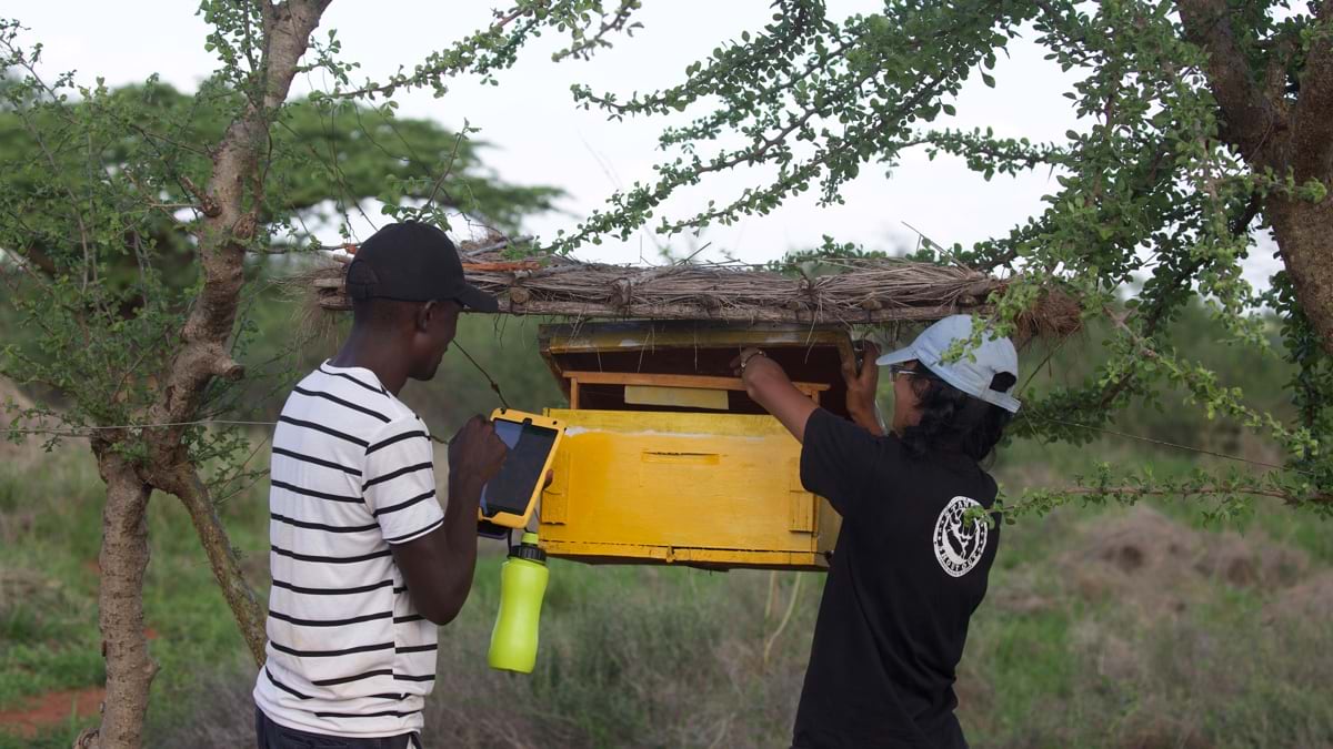 Monitoring beehive fences now incorporates a digital workflow, saving time and improving awareness. (Image by Naiya Raja courtesy of Save the Elephants)
“There was a lot of work that went into data collection between the handhelds and digitizing and maintaining all the other records that come with that data,” said Gloria Mugo, a GIS officer and remote sensing scientist who joined the Elephants and Bees Project in 2016.
Mugo and the other officers saved time by deploying ArcGIS Survey123, a GIS app that works on smartphones and tablets. After digitizing their questionnaires, the officers could visit farmers and collect data in real-time. The result, Mugo said, was transformative. “It slashed our working time from around 80 hours a month to about 16 hours.”
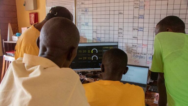
As data comes into the office from the field, staff ensure that records are properly analyzed and stored. Reporting is also much easier, giving staff more time for analysis rather than data entry.
Data collected with Survey123 is then visualized with ArcGIS Dashboards. Together, these tools convey information about elephant movement, crop raids, and beehive fence maintenance. The collected data is hosted and visualized with a single system, making it easier to see which regions might need enhanced support and optimal locations to expand the program. As a result, the Elephants and Bees Project increased the number of farms in the beehive fence program. They’re now protecting 47 farms in Sagalla—a community in Voi, Kenya—up from 30 farms.
Exploring New Methods of Understanding Elephant Migration
With the time saved by using geospatial tools, Mugo and the Elephants and Bees Project staff can focus on other important work. While beehive monitoring is still key to their efforts, officers have also trained farmers in conservation agriculture methods, built a women’s enterprise center where local women weave baskets and knit bee suits and bags to generate alternative income, packaged “elephant-friendly” honey and other products, and developed an elephant conservation curriculum and have produced a Human-Elephant Coexistence Toolbox.
The toolbox is a wealth of knowledge for communities hoping to resolve human-elephant conflict and includes strategies from across Africa. “The toolbox has instruction manuals for many methods you can use to deter elephants—not just beehives. Other places are dealing with these conflicts, and we’ve been able to communicate to a wider audience so that people can learn from these tools and methods. No one method will work everywhere, and new learnings from the field will feed back into the toolbox,” Mugo said.
The toolbox includes details on elephant behavior and why they’re an important species as well as farm protection methods, elephant-compatible farming practices, habitat information, and guidance on living near elephants.
To benefit elephant diets, Mugo is researching whether specific plants are attractive to elephants, using imagery and remote sensing technology. She recently published a paper confirming that Sentinel 2A imagery can be used to visualize vegetation species distribution.
“We’ve been able to overlay elephant tracking data that was collected with a handheld GPS, and we can see that wild African bulls walk a particular path for a specific plant they love eating. Family groups will walk paths that lead to plants that females and young calves prefer. When they move together, they walk paths that ensure there’s something for everyone,” she said.
Remote sensing expands research possibilities because officers don’t have to be on-site to collect data. Ihwagi and Mugo see its application as a promising way to understand the nuances of elephant behavior continent-wide. Paired with GIS, it gets them one step closer to realizing their dreams of seeing Africa’s elephants repopulated and understood as a crucial species of the continent’s biodiversity.
“The communities, people, governments, and stakeholders who are involved in trying to protect these elephants need to visually see data and information, which is something we can’t do without GIS,” Mugo said. “It helps us get to a point where we have a higher understanding of all the systems that are interconnected.”
Key Takeaways
- The Elephants and Bees Project, an innovative approach by Kenya-based Save the Elephants, helps farmers build beehive fences around farms to reduce elephant crop raids.
- GIS officers with Save the Elephants use geospatial tools to efficiently track elephant movement and understand their migration patterns and behavior.
- The time saved using automation allows researchers to explore other methods and technology applications that can advance the organization’s mission.