Three Ways ArcGIS Mission Improves Daily Security Operations
ArcGIS Mission is well known for supporting strategic events and incident response when command and control of a situation are paramount. Mission makes command and control possible by establishing a constant flow of real-time communication between the command post and responders in the field to ensure resources are where they need to be when they need to be there. Behind the scenes, mission-critical data is securely stored for after-action analysis and review.
The benefits of having command and control, tactical team awareness, and after-action review in one application enable organizations to use ArcGIS Mission to support a variety of security operations including:
- Strategic events
- Incident response
- Daily operations
What’s your mission?
Get in touch with an Esri representative to learn more about how ArcGIS Mission can streamline your security operations with to your organization’s existing ArcGIS Enterprise deployment.
In 2021, Cobb County, Georgia utilized ArcGIS Mission for strategic events surrounding the Atlanta Braves Playoff run. Before, during, and after the games, ArcGIS Mission was used to visualize critical information, track resources, and communicate between the operations centre and roving patrols. ArcGIS Mission enabled incident commanders in the operations centre to make tactical resource assignments and receive real-time updates from the field, then share information across teams.
ArcGIS Mission is also designed for responding to emergency incidents and natural disasters when organizations need to track their staff in the field, collect damage assessments, and perform search and rescue functions. It enables agencies responsible for emergency response and recovery to visualize critical data with a geospatial lens, plan and execute emergency operations, and facilitate multiagency, interoperable communication to ensure the safety of the public as well as first responders.
ArcGIS Mission for Daily Operations
Similar to strategic events and incident response, daily operations can be enhanced with ArcGIS Mission. There are many types of daily operations efforts that can benefit from this all-inclusive command–and–control solution such as the following:
- Site, facility, or school security
- Executive protection
- Crime control strategies
- Emergency readiness / emergency call out
Here are a few examples of how ArcGIS Mission could enhance the safety and security of your organization when performing daily activities.
Integrated Command and Control
In Mission, users have one solution to pre-plan, assign resources, share information, communicate with team members, and review incidents.
ArcGIS Mission allows you to plan your daily operations. Users can pre-plan the operational picture around their facility, executive travel, or prepare for emergency operations drill. Using ArcGIS Mission for planned operations can help plan for an event or an incident that has not occurred yet. Emergency call-out missions could be created and active in the event of active shooter incidents, natural disaster incidents, and many more. Mission has the ability to dynamically integrate new information, intelligence from external sources, and organizational data into your common operating picture. By layering imagery, live weather, and dynamic feeds of operational data on your mission map you add context to your mission enhancing situational awareness and decision support.

Tactical Team Awareness
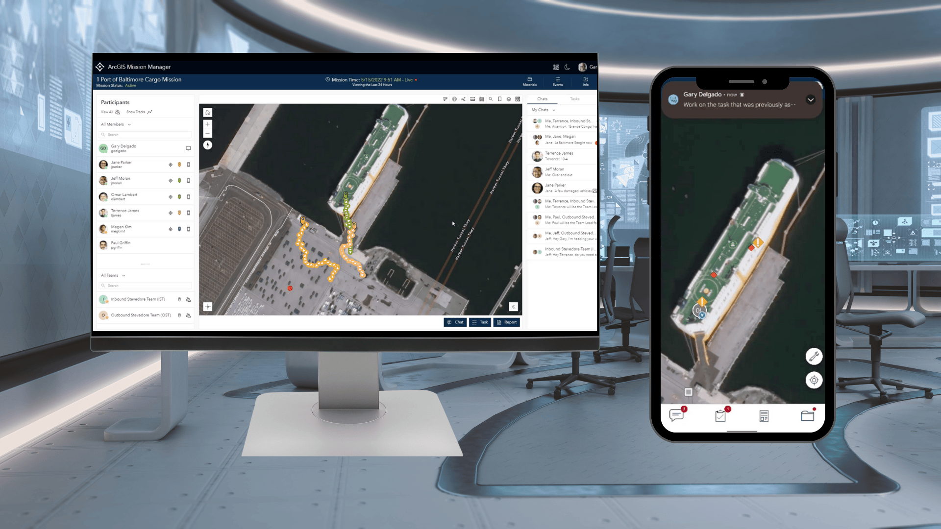
In daily operations, users can visualize where personnel are and coordinate movement among team members based on real-time events and activity in Mission. ArcGIS Mission Responder and ArcGIS Mission Manager can allow all users to have tactical team awareness.
ArcGIS Mission Responder is the one application that field personnel can use to conduct their day-to-day duties. Users can locate themselves in relation to other responders in the field. They can also orient themselves by seeing their location centred around the Mission Map. The Mission Map can contain dynamic and static layers, increasing the tactical awareness of the Responders. To add context to their day, responders of daily operations can track the mission’s activities by monitoring the Mission chat feeds and browsing the completed Mission Reports for awareness.

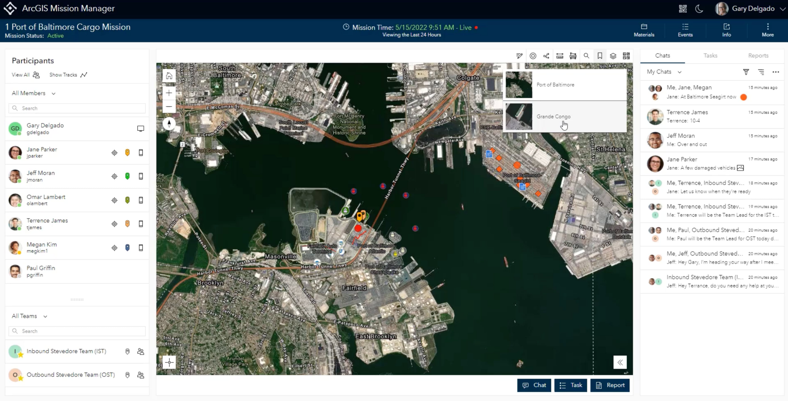
ArcGIS Mission Manager, suitable for an operations centre or a watch officer, can be used to track the locations and activities of the responders. Users have the ability to see the past and current locations of the responders in relation to the operational picture of the Mission Map. They also can track all communications of teams, allowing them to stay aware of recent events and findings.
Improved Understanding
By leveraging mission data in ArcGIS, users can gain insights, increase transparency, and build trust with their team. Improved understanding can come during a mission or once a mission has been completed.

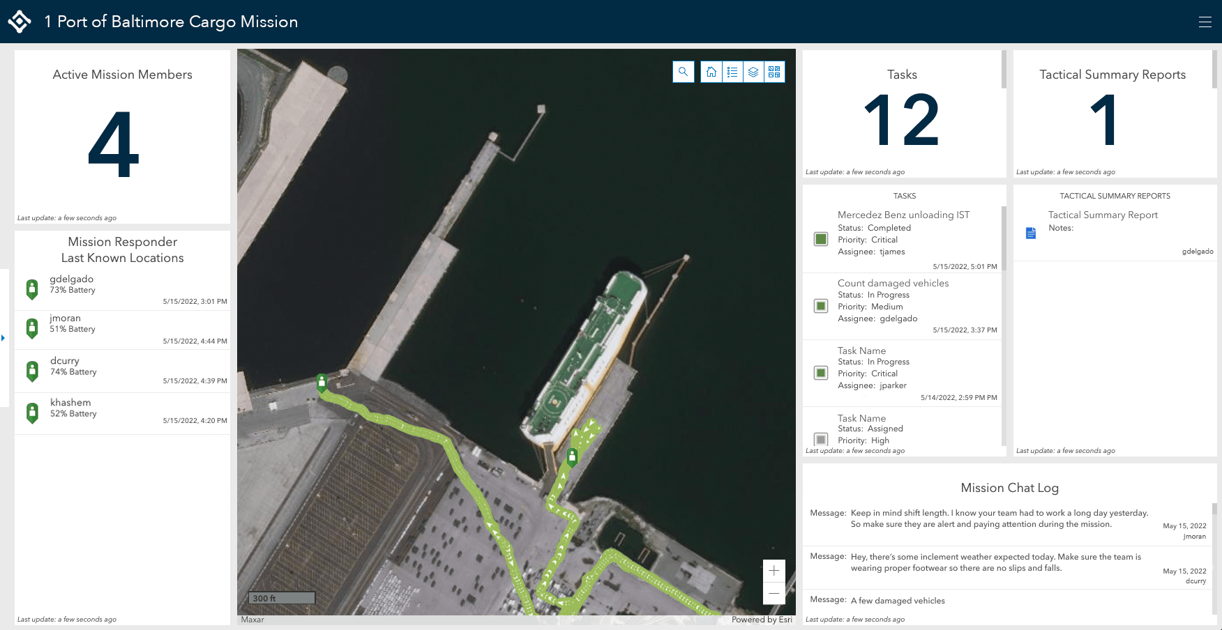
During a mission, your organization can utilize the live information being collected in the mission in other applications across your enterprise. One great way is by using the Mission Dashboard where you can customize your operational view. Multiple streams of information come together on a single screen where Mission observers and decision-makers can leverage one dashboard that provides insightful views of geographic information in real-time and of past events. Filter through incident reports, tracks, chats, and other data in time and space to focus on areas of concern and team accountability. This engaging view of key mission data enables supervisors, executives, and commanders to achieve and replicate mission success.

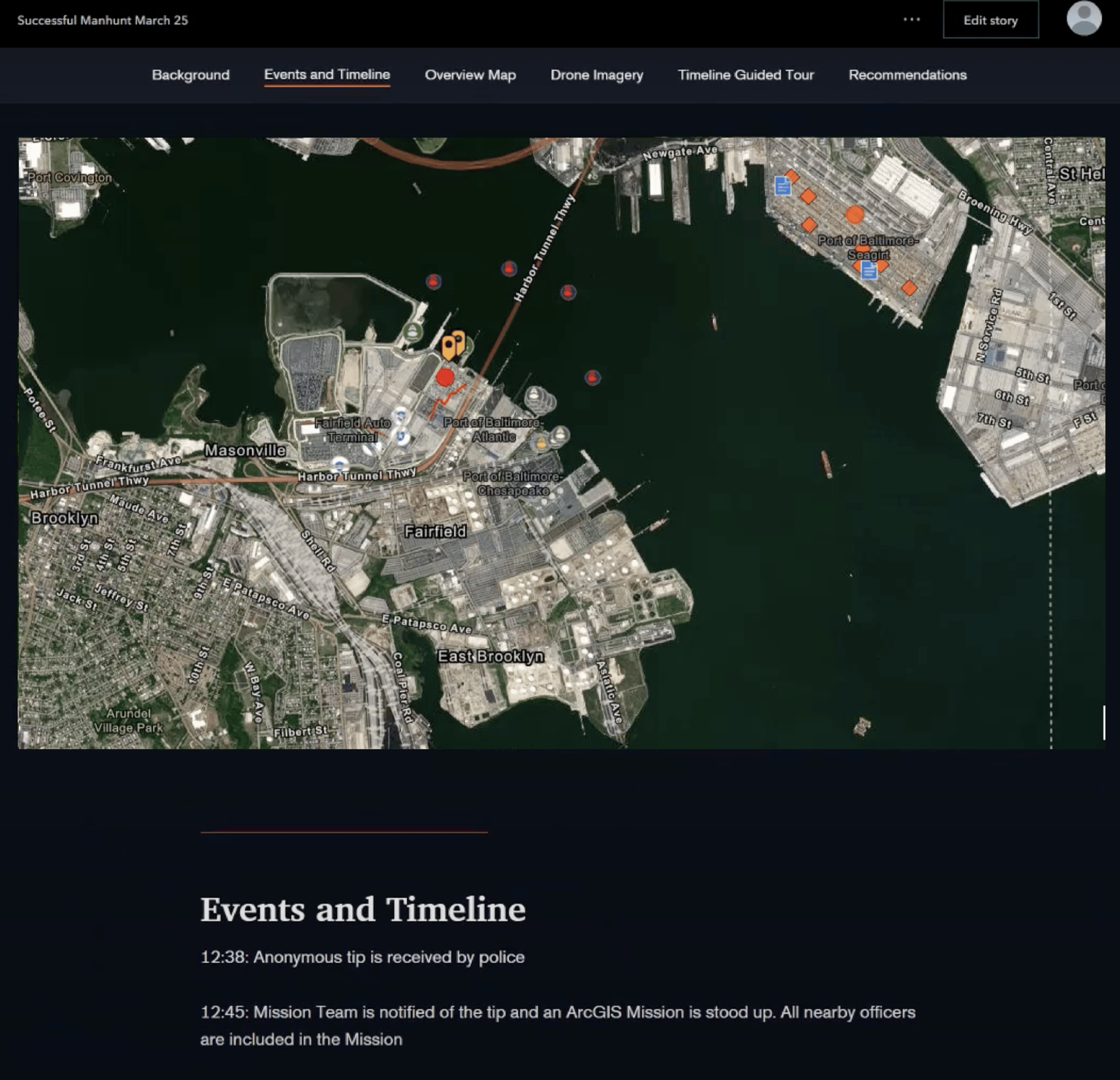
Mission data can also be leveraged by other applications in ArcGIS for after action review and temporal analysis. ArcGIS Story Maps allows you to replay mission events in a narrative brief by combining text, multimedia, and interactive maps. This story can be used for reviewing events of a specific time or events occurring in a specific location for operational transparency. In desktop applications, like ArcGIS Pro or ArcGIS AllSource, provide deeper analysis by detecting and understanding patterns that occur in your daily operations; giving you the ability to mitigate security vulnerabilities more efficiently and to improve future operations.
What’s your mission?
Get in touch with an Esri representative to learn more about how ArcGIS Mission can streamline your security operations with to your organization’s existing ArcGIS Enterprise deployment.
