Empowering Utilities with ArcGIS Living Atlas of the World
As a GIS practitioner who has worked closely with electric, gas, and telecommunications utilities, I have seen up close the impacts that storms, fires, and flooding have on utility infrastructure. When these catastrophic events occur, the impact on utilities can be time-consuming and costly to recover from.
In many utilities, GIS personnel, engineers, and field crews are being tasked to work together to create detailed disaster response and recovery plans. A significant part of these activities entails gathering datasets and creating maps that provide stakeholders within the utility with the tools and information they need to understand how their infrastructure is being impacted by these adverse events.
Pulling together these resources requires a good understanding of your utility network as well as insight into relevant data that is available outside of the organization. Locating, vetting, and preparing a dataset for integration into enterprise systems and applications can be a time-consuming process, and the response to severe weather events requires authoritative data that can be put in front of stakeholders rapidly.
This is where ArcGIS Living Atlas of the World comes in…
The ArcGIS Living Atlas of the World is a rich collection of applications, maps, and datasets curated by Esri and the user community, which are available for use in ArcGIS Pro, ArcGIS Enterprise, and ArcGIS Online.
ArcGIS Living Atlas of the World data can be integrated into new or existing ArcGIS Online or ArcGIS Enterprise applications with a few clicks. The easy-to-use configuration and customization options provided across Esri’s suite of ArcGIS Online and ArcGIS Enterprise tools and products make customizing the presentation of the data and building out an experience for users a breeze.
Here are a couple of examples of ready-to-use feature layers and applications that help utilities prepare for severe weather events:
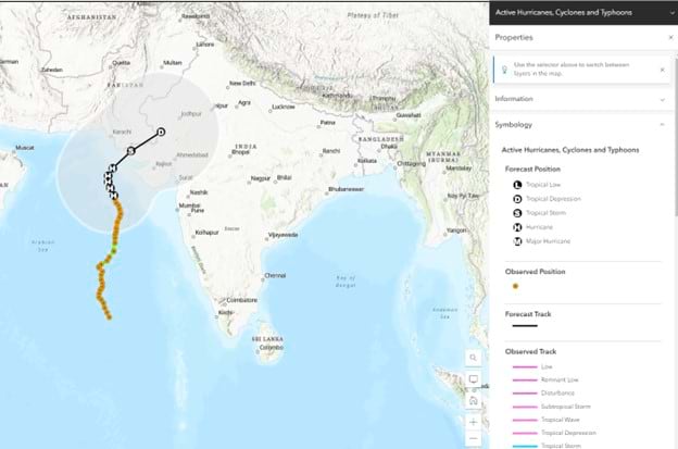
The Active Hurricanes, Cyclones, and Typhoons feature layer updates the status and track of the storms every 15 minutes with detailed attribution along the entire projected path. The dataset also contains information about weather alerts such as storm watches or warnings. This can help provide critical insights to utility stakeholders as storms approach and help them plan accordingly.
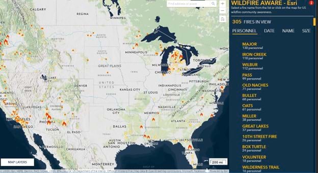
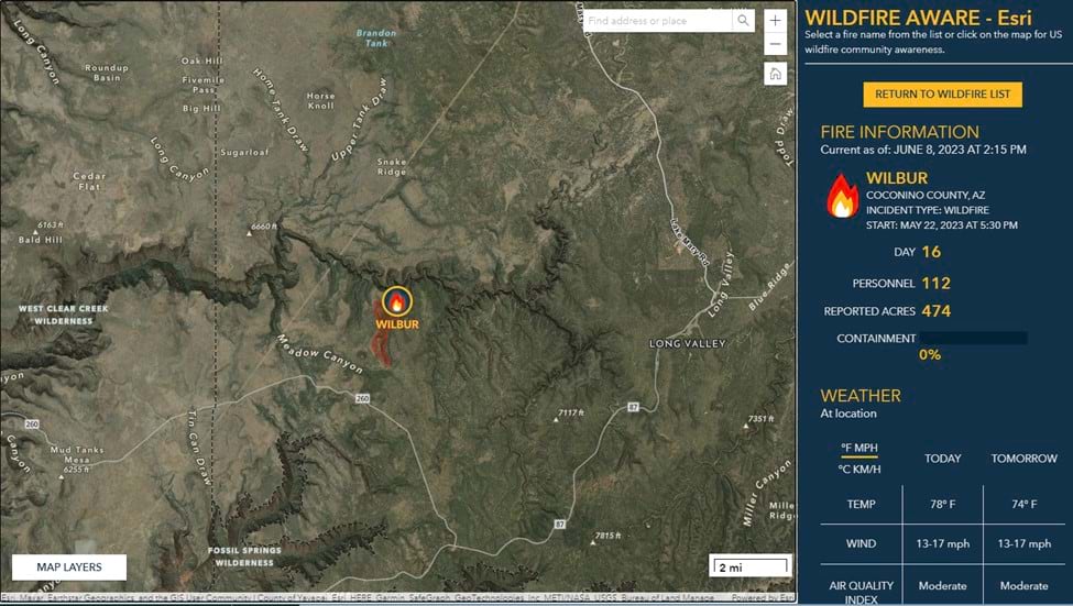
Wildfires have a catastrophic impact on utilities each year. To maintain awareness, you may want to consider a pre-existing application built to monitor wildfires across the United States.
The Wildfire Aware application within ArcGIS Living Atlas of the World contains real-time visualizations of current wildfires across the United States. This application provides demographic, environmental, and health information for active fires with regularly refreshed data from 22 different layers.
If natural disasters are preventing utility personnel from reaching a location it may be difficult to assess the state of infrastructure.
To help with these challenges, ArcGIS Living Atlas of the World contains feature layers with live traffic data from the World Traffic Service.
This dataset updates every five minutes, using easy-to-understand symbology which allows the viewer to quickly assess the situation.
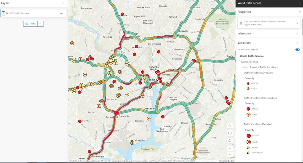
This type of information is valuable in planning disaster response and field crew routing to ensure personnel reach their destination in an efficient manner.
Wildfires, floods, and hurricanes can be unpredictable and preparing to respond requires leveraging different datasets together with one another to gain as complete a picture as possible. Living Atlas of the World gives you access to trusted, curated data sources that can be integrated rapidly and simply into existing workflows within your organization. The insights gained from the Utility Network in conjunction with the dynamic data of ArcGIS Living Atlas can help utilities make data-driven decisions for natural disaster response and planning.
To read about the latest developments with the Living Atlas of the World, check out this blog detailing new features and capabilities now available in Living Atlas of the World!
