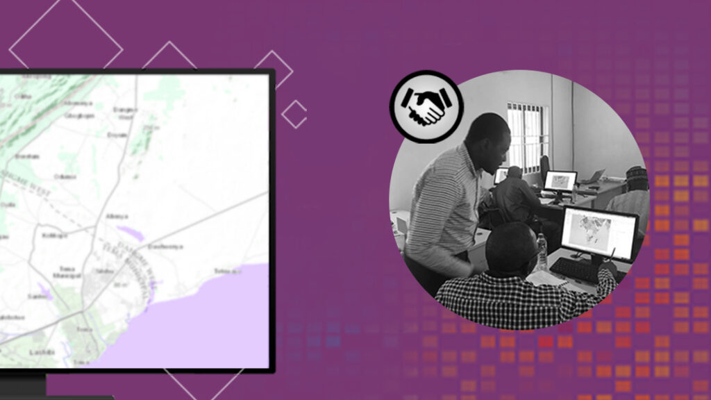
Collaboration in a GIS Environment.
Your Best Achievement Needs a Second Pair of Eyes at Least
When we do certain things at our workplace, we tend to think we have the best knowledge, experience, and understanding of the subject matter. It is very easy to see yourself as an “authority” especially when doing certain things that are directly tied with your core objectives. Often, the desire for fame and recognition by the management and the entire public pushes us to want to do it all alone. At the end of the day, the task will be done but you would discover that it could have been better if there was a collaboration.
It is important to note that, collaboration in this context, does not entirely translate to having another person share a part of the workload with you. It is achievable by just getting two or more people involved in the least things which in no way negates your sole ownership of the job. For example, asking colleagues to help during their free time matters a lot and does not mean that you do not know what you are doing.
Hi Tope, check out this map, do you think the symbol I used for potholes is appropriate? What do you think I can improve?
The advantage of this goes beyond improving your productivity.
Some of the benefits of collaboration could include:
1. Your output will improve significantly. When you ask for other opinions about a work in progress, you will certainly have a great result. It follows the popular saying that “two heads (pairs of eyes) are better than one (a pair)”.
2. It saves you time and other resources. When you collaborate with others or at least, get their opinions for consideration in your work, it makes you work with speed and the chances of having a do-over are greatly minimized. You can easily focus on spending your time doing more productive things rather than going to correct errors pointed out during your “self-furnished” presentation.
3. You will get all the support you need. For example, when presenting a project to the management, your colleagues will be more eager to support you during the presentation, because more than half of the panel already has input no matter how little in your work. They might end up asking fewer questions and some would eventually answer these questions on your behalf.
4. It improves your self-confidence. You must have answered questions from your colleagues during the times you consulted with them. You would have provided relevant responses to their concerns and implemented some of their ideas. It is often rare for a colleague to ask you questions that have already been answered, and this will boost your confidence during the presentation.
5. The team will become more united. Knowing that you value the opinions of others will open an avenue for them to invite you to offer yours in their assignments. Each team member has some peace of mind when they are surrounded by resources that largely impact their tasks positively. You build your interpersonal relationships and above all have a healthy work environment and culture that would be nearly unachievable in a “loner” kind of setup.
6. You get new inspirations. There is always a better/faster/more efficient way to get something done or achieve the desired result. Consulting with colleagues makes way for new ideas to improve your work. Sometimes, you could be working with an “obsolete” methodology, and it will be embarrassing if it were to be pointed out when making your “final” presentation to your managers or customers.
7. It is an avenue to teach and learn. Knowledge sharing is one of the ways we grow. When there is someone that knows about something within an organization, there should be someone that teaches as well as someone that learns. It is always tempting to think we can do things on our own. One could register for a MOOC to learn new tricks on how to use Survey123 for ArcGIS for example, while your colleague has previously used this application in a different situation and has the cheat sheet in his head. When we collaborate, the possibilities are limitless.
The list above is just a few of the benefits. Several platforms are also available to facilitate this collaboration. For instance, the Sambus Geoworld, Esri Geonet Community, ArcGIS Online, Stack Exchange, Slack, and GitHub to mention a few. The Spatial Community on Slack is a good example of a community for collaboration. It has over 2800 members who are geospatial enthusiasts with fields ranging from developers, GIS professionals, students, and hobbyists.
The Esri Geonet community is a great place to ask people from all over the world for help such as troubleshooting and clarifications on technical problems. These people use the same software as you and it is rare to have a problem/difficulty that no one has had before. This community is also where bugs in these software solutions are reported. You can also suggest new features and vote for other people’s suggestions so that the Esri team can approve and create the feature(s).
On your organization’s ArcGIS Online or ArcGIS Enterprise Portal, you can also take advantage of the commenting system to collaborate with your colleagues in-house or offshore. This functionality specifically allows people in your organization with access to a portal item to write comments and contribute to your work. Comments are a great way to get feedback, reviews, and suggestions about portal contents. So next time you create a web map on ArcGIS Online before you send it for your presentation, ask your colleagues to check it out and leave comments for you.
Commenting is one of the free things you can do on ArcGIS Online with no cost towards your service credits.
The take-home from this is to start collaborating.
Yes – you can do it, all on your own and it will be good. But you can also do it better by collaborating and this does not stop you from “owning” your work.
Remember, it is easier to make use of resources around you before reaching for those far away! Kindly know that this does not replace your research, and other lookups you need to do.
 Author: Clement Bamidele OKE : Clement is a GIS Analyst and Developer who helps GIS users find effective and innovative solutions to spatial problems. He has experience working for both government and private organizations applying different aspects of geospatial technology ranging from remote sensing and GIS to software development. At Sambus, he is focused on geo-solutions, demonstrations, and professional services. He provides expertise on ArcGIS Pro, ArcGIS Online, and ArcGIS for Developers. He holds a bachelor’s degree in Remote Sensing and GIS from the Federal University of Technology, Akure. In his spare time, Clement likes to play video games, cook, write/read, watch movies, and go on adventurous trips.