ArcGIS for Utility Asset Management
Utilities all through the world are confronting unprecedented changes – from privatization of government- owned utilities, renewable energy down to rivalry for discounted and retail clients. In addition, mergers and acquisitions are equally adding new components of risk to the management of utilities today. This is a great problem lurking on the horizon. Energy and water suppliers are unable to depend on administrative security of region and clients. Individuals who are not influenced by direct deregulation are confronting increasing mindfulness by their key clients of cost and service alternatives. New instruments and techniques are required for capital- intensive companies to stay competitive in the marketplace. Better utilization of spatial information is one of the key areas of focus for most utilities today.
ArcGIS is developing as a significant planning, execution, and activities management tool for the utility enterprises, for example water supply, wastewater, and health. Utilities have become the nerve hub and essential infrastructure requirement for development, hence utility execution companies or firms must guarantee that their distribution channels and technologies remain functional with no breakdown. The authorities ought to guarantee regulation or guidelines in customer services and reduce the number of breakdowns on a Standard Offer Service (SOS) level. This can be challenging, as one must ensure prudent management of such systems for the task to be substantially flexible. Thus, the requirement will mean – a system conditioned visually on a geographical data, to facilitate easy tracking and attention.
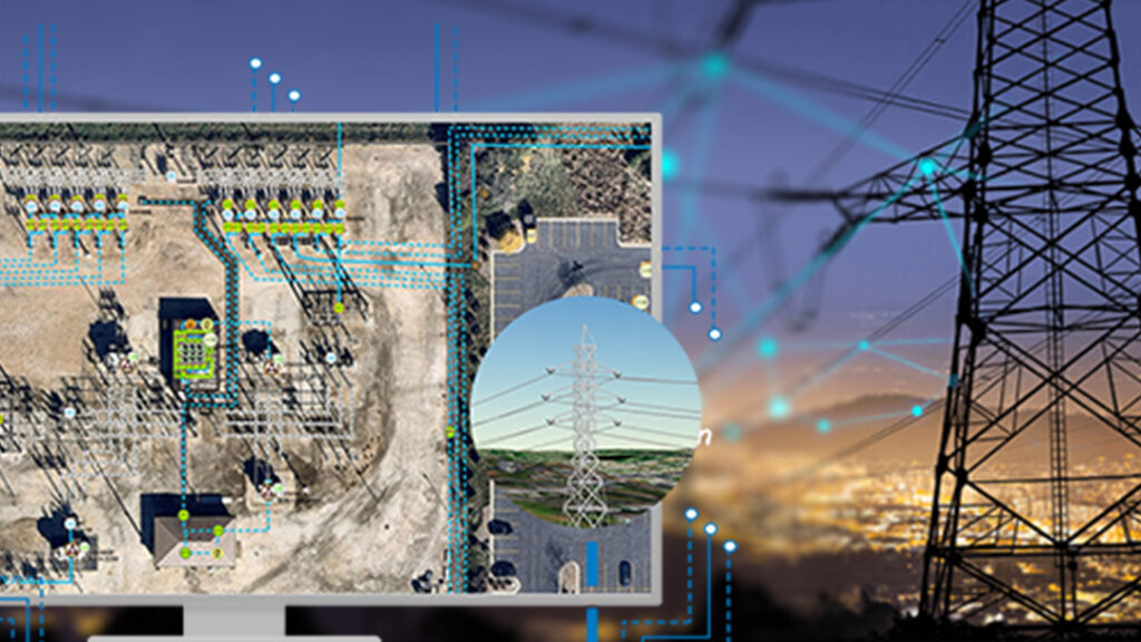
In a Geographical Information System (GIS) environment, the real physical structure of the distribution system – where the lines run, where the connections are – can be copied, modeled or displayed on the computer, as can the entirety of different objects, similar to roads, structures, and land demarcations, that have a bearing or orientation on the distribution system. Utilities need the advantages of a genuine and true enterprise geographic information system to map assets, manage facilities and also aid in the planning, supervision and the actualization of cross-cutting applications for smoothing out operations, driving down expenses, and improving client service.
The ArcGIS system thrives on Location intelligence. This system utilizes location to fine-tune assets or resource management. It gives new experiences and insights about execution, risks, assets, resources and expenses. Utilizing the ArcGIS location platform, utilities managers can find patterns that straightforward simple reporting detailing will be unable to find, thereby improving electricity management results. ArcGIS does this in three different ways: managing asset data, surveying performance and optimizing the asset life cycle
Managing Asset Data
Electricity managers will in general sort out data from numerous different sources — enterprise asset management (EAM), work management, real-time data, metering, customer management, and network analysis systems. ArcGIS provides a new, complete network model that connects these technologies, expending critical data from numerous sources to give a total image of the electric utility system.
Surveying Performance
ArcGIS conveys insight knowledge into the past, present, and future performance of the assets of the grid. Visualizing every asset’s condition and its context to location is fundamental to any asset management system. ArcGIS further evaluates performance by uncovering assets weaknesses or vulnerabilities, anticipating/predicting performance, and providing transparency. The outcome of the performance assessment is a risk profile, considering weakness and illustrates the consequences of failure.
Optimizing the Asset Life Cycle
At the heart of any electricity asset management is the optimization of resources or assets. ArcGIS streamlines the whole asset life cycle by revolving it around location—organizing and coordinating capital and operational plans, and adjusting cost, risks, execution, and compliance. ArcGIS is completely lined up with the ISO 55000 standard series, giving significant regulatory compliance functions. It additionally encapsulates undertaking abilities to maintain records, connect all partners or stakeholders, and uncover profound analytical insights. This makes for better electricity resource speculation, security, and operational choices.
Utility management faces massive difficulties today and this shows no sign of slowing in the future. Utility managers have invested huge finances into their assets and should in turn make financial gains as expected. However, that may slip if technological tools are not involved in this envisaged advancement. ArcGIS brings an incentive to each utility irrespective of how its asset management practice has developed. As utility companies observe ISO 55000, they will require better instruments to adjust cost, risk, performance, and compliance. Location is a basic trait of utility resources and that is the reason geospatial innovation and, particularly, ArcGIS is a necessity for any utility system rather than the perceived add-on to fine-tunes asset management systems.
Article by
 Sambus Geospatial