GIS DAY 2022 IN NIGERIA AND SAMBUS CONTRIBUTION.
GIS Day is organized yearly 3rd Wednesday of November across the world which Nigeria is not left out. Different sectors registered for the 2022 GIS Day celebration in the nation. Sambus as the official distributor of ESRI was at the forefront supporting and encouraging organizations to register. Specifically, Sambus Geospatial Nigeria office organized events to celebrate GIS Day/Week. It started on Monday 14th and ended Friday 18th of November.
The event captured GIS Day at secondary schools, universities Sambus Geo-stakeholders conference with industry expert and GEOSON conference presentation. In the Education area there were different modes and school categories. The first mode was physical, and the second session was virtual. Likewise, there are secondary schools and University categories. The stakeholders involved professionals in different sectors using GIS in their operations. In the GEOSON event a presentation was done on the “role of Geospatial technology in election monitoring” to buttress the importance of geospatial capability in Nigerian elections.
An Introduction to Maps: GIS Day in Secondary Schools
Event took place in Oke-Ila Schools in the remote area of Osun state (the first secondary school GIS Day in the southwest) explaining digital and paper maps differences. Likewise, government science secondary school, Maitama showed a strong interest in learning the Digital Maps.
- Oke-Ila Secondary Schools, the participants are from two (2) schools; Hope and Glory Secondary School and Abolarin College. It was a virtual event with a total of 52 persons. The event had the students of Geography gathered in the Hope and Glory school location and presentation took place virtually.
The World Imagery Wayback was used to demonstrate to compare different areas at different times.
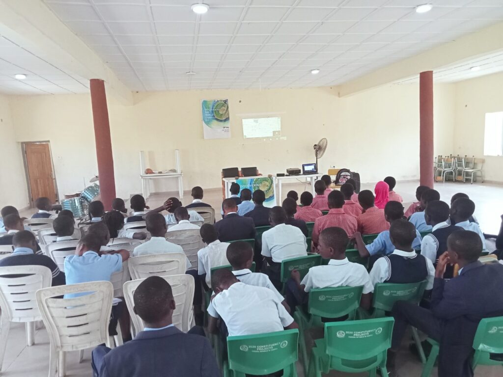
- Government Science Secondary School, Maitama, the event took place physically with 50 selected Geography students in Secondary schools (SS3).
Presentation involved the Introduction to Maps with demonstration on World Imagery Wayback in other to compare different areas at different times. Likewise, BaseMaps was illustrated on the ArcGIS Online.
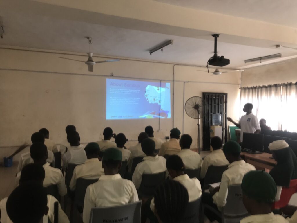
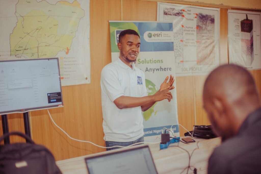
GIS Day in Universities
For the Universities, we organized, helped with registration, and gave out 5 licenses to each school. Likewise, story map coupon was given by ESRI/Sambus for student practice
The specific arrangement is as follows.
- University of Abuja
The event took place for 2 days (Monday and Tuesday) with Undergraduate in Geography and master’s student in Geography. The day witnessed demonstration on signing up for 21 days license and Africa Geoportal account. Introduction to GIS data types, digitizing, and map embellishment.
- Rivers State University
This took place virtually on Thursday with 13 students present physically at the school lab. There are in Women in surveying and 2 other groups related to the group. “Careers and Application in GIS” was presented to the students, to make them see the numerous opportunities in GIS. There was demonstration on signing up for 21 days license and Africa Geoportal account and Survey123 to collect information on Internally Displaced Persons in Nigeria.
- University of Jos
This took place virtually on Friday with at least 50 students present physically at the school lab. “Careers and Application in GIS” was presented to the students, to make them see the numerous opportunities in GIS. There was demonstration on signing up for 21 days license, Africa Geoportal account, Survey123 to collect information on health centres.
- University of Calabar
Interactions with University of Calabar Students on Africa Geoportal community platform. The event talked on sharing, editing, and collaborating with others.
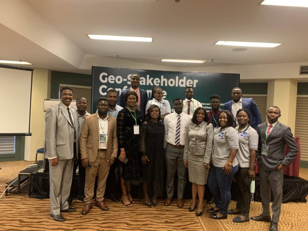
Advancement of GIS: Geo-stakeholders Conference
Sambus Geospatial Ghana and Nigeria offices celebrated GIS Day sharing the advancement of GIS Nigeria with a total of sixty-six persons attending the GIS Day session.
To commemorate the GIS Day session of the event, three (3) speakers were invited to speak. They included:
- Mr. Francis Andorful – Senior GIS/ Remote Sensing Technician at the University of Ghana’s Remote Sensing and GIS Laboratory, Department of Geography and Resource Development. He spoke on the subject, “success story of using esri products to tackle the pressing issues in the geospatial industry in ghana”.
- Mr. David Nyomo Jeb – Managing Director of GeoApps Plus Limited, the commercial department of the National Space Research and Development Agency, Abuja. He highlighted some of the successes chalked by the National Space Research and Development Agency, as well as some of the challenges being faced.
- Ghassan Schbley – Regional Partner Manager WAMEA, ESRI. He highlighted on the importance and usefulness of the Africa Geo-Portal platform.
GEOSON Conference
On Day 2 Tuesday 15th November 2022 of GEOSON Conference, the technical and industrial presentation took place, in which a Sambus staff presented on the Role of Geospatial technology in Election monitoring with assistant from Bamidele Clement Oke – Technical lead, Nigeria. The presentation was for about 15minutes which questions followed up after. Four Questions was raised based on Security of Data, Inclusion of Diaspora, sources of Data and Network connectivity. All Questions were answered.
How was GIS Day in Nigeria?
Generally, the sessions involved creating the events and registering them on ESRI gisday.com website. Nigeria witnessed a better output of registration for GIS Day 2022. The usage and popularity of ESRI ArcGIS has gained much better level in the country.
Click here to watch the GIS Day virtual session at Oke-Ila schools, Osun State, the first celebration in secondary school in the southwest
More Information
Visit Esri Blog to read more.
Source: Olivier Cottray 2022, Esri, accessed 10 November 2022, <Esri Blog>