Surveyors track earthworks daily with fast, accurate drone data
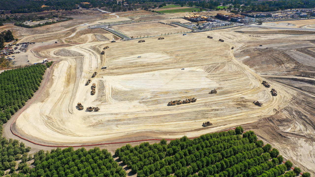
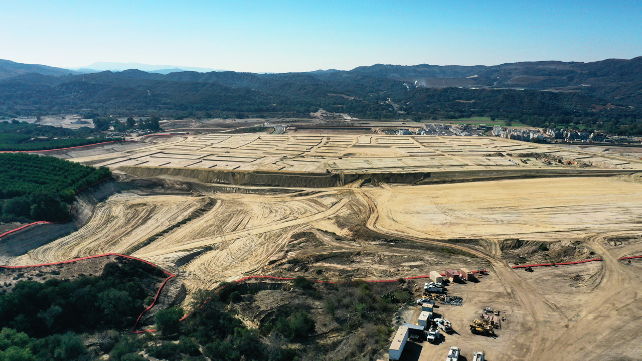
Rancho Mission Viejo has been developing large-scale, master-planned communities since the late 1960s. A typical development phase can exceed 100 acres (40 ha) and include anywhere from 600 to 900 graded lots for sale to home builders. Grading contracts have ranged in size from 1 to 25 million cubic yards. So they also hired a survey and GIS company called Turnpoint Geomatics to track work being done in order to pay the right price for it.
“Rancho Mission Viejo hired us to track the daily earthwork quantities,” said Ken McDonald, drone pilot and GIS analyst at TurnPoint Geomatics. “Anytime the lowest dirt [remedial] cut is made, we fly and capture drone data to track it. That’s how the grading companies are paid.”
TurnPoint Geomatics started out surveying earthworks on foot, with a GPS-equipped backpack. They’d then map the data points into a model, but this was getting time-consuming. So they turned to drones, particularly the DJI Phantom 4 RTK. While this was a massive improvement, it still took a lot of time to set up ground control for the small segments’ multirotor cover. Then, three hours to fly the complete site.
CHALLENGE
Large areas, fast site changes, proof of precise quantities and levels to contractors, clients and government
“Reflecting on how we could continue to improve this process, we wanted a better solution for the next phase of work. Enter the WingtraOne. This allowed us to fly higher and faster with less ground control, and the entire site took 35 minutes to complete. – Ken McDonald – Drone pilot and GIS analyst at TurnPoint Geomatics
“We give them a cut-fill balance, every day”
Moving huge volumes of dirt is a costly service. The process of estimating the price has changed dramatically with the entrance of drones into construction and earthworks workflows. Decades ago contractors could charge more because there was no way to measure the exact amount of dirt or verify what had been moved. Now measuring and validating is the norm, via repeatable, low-cost aerial surveys with drones.
“You know, grading companies could only estimate quantities at periodic intervals,” McDonald said. “We can track the ground to exactly what’s going on and give our client a cut-fill balance, every day. So, when the grading company now bills our client, they come to us first and verify the price. So that’s how well we watch over our clients.
“Nobody I know has been able to track it like this. They can pretty much guarantee we’re going to be able to tell them so that we’re saving them lots of money.”
Rancho Mission Viejo can back this up itself: “Over my last 20-plus years with Rancho Mission Viejo, I have driven the use of technology to improve our efficiencies in all aspects of our work—particularly the tracking of earthworks,” said Jack Morales, Senior Vice President of Community Development at Rancho Mission Viejo.
“With up to five equipment spreads moving dirt at a time, ‘ground measurement’ has always been educated guesswork, leaving untraceable voids in the final product.”
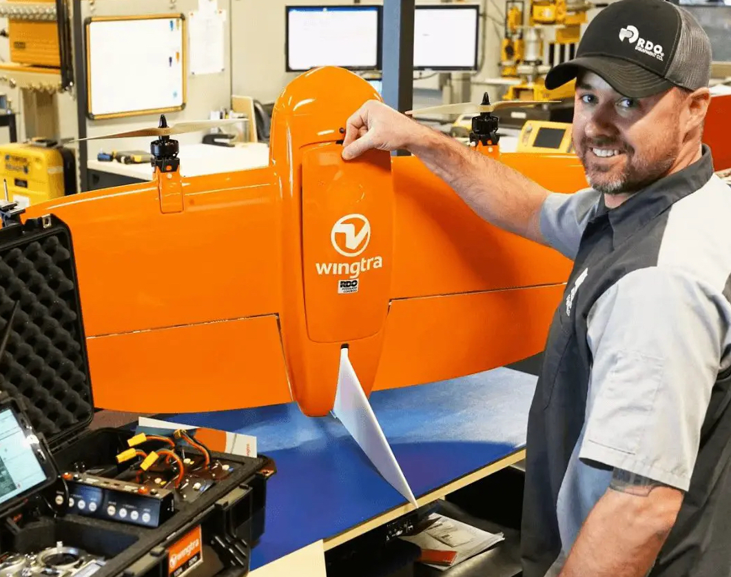
Several years ago, Morales’ team tasked McDonald to research the latest drone and software tech. After experimenting with other products, he found WingtraOne.
“This tool has been a game changer for our daily operations,” Morales said. “The speed and accuracy of tracking the movement of earth and inspecting the installation of infrastructure improvements are unmatched.”
“In addition to reliable results, we have also saved substantially on ground man hours and, most importantly, kept Ken and other TurnPoint personnel safer by reducing their exposure to moving equipment.” – Jack Morales – Senior Vice President of Community Development
The Wingtra difference
To Wingtra distributors and partners, the sale of a Wingtra is not the end but rather the beginning of a relationship. The goal is to make sure that anyone flying the drone is confident and achieves their goals. It’s not just about customer service and an amazing product. It’s about a relationship that results in customer success.
In this case, TurnPoint Geomatics was purchased from our partner RDO Equipment, and this approach was clear.
“The support we received from RDO was instrumental in our success when initially setting it up,” McDonald said. “Their involvement overall eased our onboarding process.”
Cost-cutting surveys, three to four times faster
Survey firms like TurnPoint Geomatics thrive when they keep their customers happy. And they do this by offering the best quality as well as price on a service. In this case, the quality and speed of capturing of Wingtra data capture not only allows for better, frequent views, but it also boosts the speed of the entire project.
“As a professional pilot, no matter what drone I use, I can produce 1 cm accuracy,” McDonald said. “However, with the Wingtra, I can fly larger areas, cut down my field time, and take on more difficult jobs that would not have been an option before.”
Comparing the DSM and ortho from Wingtra data with GPS shots, McDonald said that his reports show points of zero discrepancies. Because the Wingtra data is so accurate and reliable, he said he can now use it to verify the final grading work so the county can sign off on it and approve the next stage of building.
“I could make it happen with the DJI,” he explained. “But to get this level, I would have to fly a lot lower, around 90 feet [27 m]. And my grid pattern would have to be tighter; my overlaps. So the flight time would be more, and I can’t fly as big of an area.”

“With Wingtra, being able to fly 400 feet with a 42-megapixel camera, you know, going 30-something miles an hour. It’s just incredible. It’s so fast and such a reliable workhorse. It’s saving everybody money and is making us a better service provider to the customer.” – Ken McDonald – Drone pilot and GIS analyst at TurnPoint Geomatics
What do surveyors do with the hours Wingtra saves?
Photogrammetry outputs from Wingtra data combined with CAD lines offer a photorealistic look at plan vs. actual work. Since he can grab daily, complete site views now with a faster platform, McDonald says he can keep a closer eye on the site and save even more time and money for the client. He can catch discrepancies in the construction as they are happening.
“I can usually catch it because they’re cutting the dirt,” he said. “And I could tell ahead of time [points to output and CAD view of a pipe in ArcGIS] that like this one here. So I know that it’s supposed to go here, right I can track the end of this instead of paying ground man hours to go out there and actually shoot the end of that pipe or alignment. I can get them within inches of it. So I’m also doing quality control work now for the next month or two. Not only grading, but I’m tracking everything being done on the ground.”
But is it really WingtraOne that makes this possible? Apparently, yes, since McDonald said the time it took to set up many, low-coverage flights with the DJI meant he may not have captured some areas as often. This meant he didn’t have a view of all of the pre-construction work before.
“If I had the DJI, I may not have this data, because it really was almost getting too costly to spend three hours to fly it. And I would maybe only do it every other day, or every three days.

“Now, I just walk out the door, get it in the air and fly it, and I come back with daily records. And this is historical data, so if in the future something goes wrong, you know, we would be able to see it. That’s why it’s so important to be able to fly it so quickly and have such great data. And that’s what the Wingtra does.” – Ken McDonald Drone pilot and GIS analyst at TurnPoint Geomatics