What’s new in ArcGIS for Microsoft 365 (August 2023)
In June 2023, the ArcGIS for Microsoft 365 component documentation was consolidated into a single site to help you see how this product suite is integrated into all of your favourite Microsoft business products.
Now that you are familiar with the new documentation, the August 2023 update is here with many significant enhancements, bug fixes, and new tools to explore.
The following sections detail these updates, per component.
ArcGIS for Excel
The following are updates to ArcGIS for Excel:
- You can use the Zoom To or Select tools on the Map Data tab to from their corresponding row, cell, or cell range in the Microsoft Excel spreadsheet.

- You can now add and edit an ArcGIS Online or ArcGIS Enterprise layer attribute table in an Excel worksheet. The changes you make in Microsoft Excel can immediately be updated in the editable fields in the data hosted in your organization. Inversely, click Refresh on the layer when you have it open in Excel and view the changes you made to the remote-hosted layer in ArcGIS Online or ArcGIS Enterprise.
- The data types that can be written to a cell are number, text, logical (true and false), or error value. When you type input in a cell, Microsoft Excel automatically detects and assigns the type.
Learn more about data types, formats, and categories
Learn more about comma, decimal point, and semicolon separators
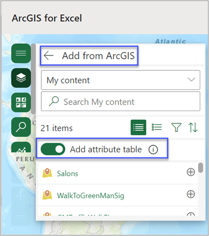
See the ArcGIS blog article for more information.
- You can use the ENRICHBYADDRESS function to get enriched demographic information about the people, places, and businesses in a specific area or within a certain distance or drive time from an address. The default distance is within a one-mile radius of the point.
- Questions around Pivot tables and others are answered in the updated FAQ topic.
ArcGIS for Power BI
The following are updates to ArcGIS for Power BI:
- The Basemap tool is now more intuitive to use. Previously, settings for this tool were managed from the Visualizations pane. Now, when the Basemap tool is turned off and you drag data into a Power BI field well, the Basemap tool is automatically turned on, allowing you to update the basemap. Click Reset to default or turn off the Basemap tool on the Format visual tab in the Visualizations pane or clear the field well to remove the Basemap tool from the map tools.
- When you select features on a time-aware layer and run the time animation, only the features visible during the specified time period are visible when playing the animation.
- Additional support, bug fixes, and improvements to the user interface have been made.
ArcGIS for SharePoint
The following are updates to ArcGIS for SharePoint:
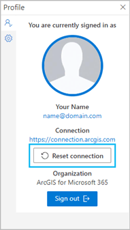
- Use the Reset connection button to remove a map’s content or switch your ArcGIS organization or portal connections.
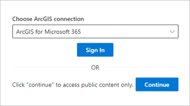
- Use new PowerShell commands to edit ArcGIS connections and control ArcGIS organization access.
- Installation and management documentation for ArcGIS for SharePoint has been updated.
- Map sharing is now disabled for Viewers, and Contributors can hide share options from Viewers.
ArcGIS for Teams
The following are updates to ArcGIS for Teams:
- The Options tab layout in the personal (private) scope installation has been improved.

- Additional search item types are available to open in ArcGIS for Teams as you search.
- Additional support, bug fixes, and improvements to the user interface have been made.
ArcGIS Connectors for Power Automate
The following are updates to ArcGIS Connectors for Power Automate:
- ArcGIS Connectors for Power Automate now include the ArcGIS Enterprise connector to access and use certain actions.
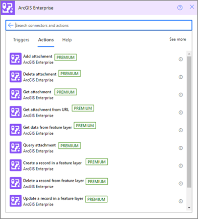
- The Find address candidates action now provides multiple results, ranked by match score, containing location information about an input.
- The Find address candidates and Geocode addresses actions now support custom geocoders.
- The token refresh issue that caused flows to break has been resolved.

