Best Drones for Photogrammetry Surveying – WingtraOne vs. Other Drones

The introduction of the first drones for photogrammetry increased the development of drone technology. Several manufacturers also emerged with claims of different data and achievements regarding their drones. Among these claims are camera specifications, flight time, and coverage. However, careful considerations are given to the drone performances based on features to determine which drone is suitable based on the user’s preference.
This article gives you in-depth reviews of the best drones for photogrammetry in land surveying including image quality tests, coverage results, usability, and specifications. Comparisons are made between VTOL fixed-wing and Multicopters such as Stockpile survey with VTOL fixed-wing, DJI Phantom 4, DJI Phantom 4 RTK, WingtraOne, and Road construction survey with fixed-wing.

Multicopters vs. Fixed-Wings for Photogrammetry
Faster surveying operations with fixed-wings, between 5 to 14x
Multicopters such as DJI Phantom 4 RTK are good choices for entry-level drone surveying when compared by price tags and ease of use. They are effective in vertical mapping and monitoring small construction sites or areas. Multicopters have low flight efficiency which makes it impossible to handle larger areas as compared to fixed-wing drones. It requires between 5 and 14x more time than fixed-wing drones to map the same area. Although Multicopters help to save cost, it is eventually overridden by the costs and time needed for a crew to map large areas.
Stockpile Survey with VTOL Fixed-Wing Vs. DJI Phantom 4
For stockpile survey, an example is the Idaho Forest Group, which cut stockpile measurement time by 80% through acquiring six WingtraOne hybrid VTOL/fixed-wing drones for the survey of its six massive timber yards. The WingtraOne fleet gathers accurate data in a fraction of the time it took with their multicopter stockpiling survey log decks and wood residual piles. WingtraOne takes only about 25 percent of the time it took with the Phantom 4 to operate. Unlike other stockpile measuring methods, Wingtra saves flight time and man-hours as most of the processes are self-functional.
Road Construction Survey with Fixed-Wing vs. DJI Phantom 4
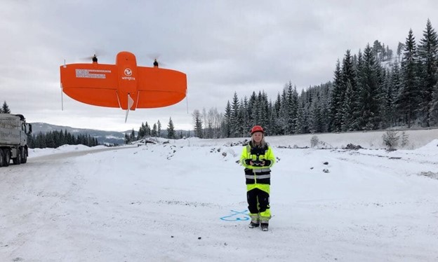
The Norwegian Road Administration Engineers decided on flying professional drones for road construction surveying. Consequent to this decision, they briefly used Phantom 4 for data collection and proved its value. After seeing the gaps in its quality and accuracy of data and budget, they settled on using WingtraOne. Based on the local hourly wage, using WingtraOne saves them 700 USD and 6.5 hours of work per 5 km of road survey. Read the full use case here.
DJI Phantom 4 RTK vs. WingtraOne
See recommendations about when a multicopter like the Phantom 4 RTK is suitable for your application and when you would be better off with a more professional-level fixed-wing drone. This in-depth comparison explored the usability, coverage, camera specifications, and image quality of DJI Phantom 4 RTK and WingtraOne mapping drones.
Best fixed-wing drones for aerial mapping
WingtraOne vs. fixed-wing drones
In terms of coverage, fixed-wings outranks multicopters by a large distance, However, some striking differences exist among fixed-wings. There might be a need to assess each drone depending on the application based on data quality, area size, flying conditions, and terrain. We discuss all these aspects and more in the following surveying drone comparisons with eBee and Quantix.
While the eBee X is well established and industrialized, features a thermal mapping solution, it surpasses multi-copter performance. However, a safe landing is a real problem making it daily a challenge for users while potentially reducing the drone’s lifetime. VTOL on the other hand solves the landing issues on gravel and confined areas, and if you need good data quality, WingtraOne will put you substantially ahead.
Quantix drone is an attempt to address the civilian agriculture market. Wingtra, on the other hand, is a company in Switzerland that addresses surveying and mapping using VTOL drone technology. For high quality and accuracy in surveying, the WingtraOne is a better drone for surveying while the Quantix is better on a tight budget when the drone is primarily needed for agriculture.
In conclusion, both fixed-wing or multicopters are good drones however, it depends on the user’s choice and the nature of the projects.
Read more about Wingtra here.