Accessing Powerful Location Data

The City of Cape Town, located in South Africa, has an enormous amount of publicly available data on the 850,000 properties within its boundaries, which includes the associated services and the wider environment. All this data can be accessed, explored, and analyzed with a variety of geographic information system (GIS) tools.
Challenge
One of Cape Town’s best-kept secrets is the huge amount of data the City has on hand and how accessible and very useful that data can be. The City’s Information and Knowledge Management Department, serving as the custodian of that data, would like this extensive amount of information, and the tools to access it, to be more widely known.
Solution
The recent launch of the revamped CityMap Viewer has provided an ideal opportunity to introduce some of the City’s powerful data tools to staff with computer access. One of the many tools accessible through the City’s spatial information portal, it provides access to the enterprise GIS (eGIS), which is used to manage, edit, and display spatial information.
This type of geospatial data contains precise location information, such as coordinates, an address or erf number, aerial imagery, and other physical aspects such as boundaries and wayleaves. Spatial information also comes with a host of other data, from deeds information or municipal valuations to vegetation and soil types.
The spatial information available through CityMap Viewer—over 220 datasets provided by more than 30 City departments—is grouped by themes, such as health or transportation. Users can search for a specific point of interest, such as a property, address, facility, suburb, ward, or subcouncil boundaries. Once these are located, they can also search for information within a specified area. The aerial imagery views (some dating back to 1926) also show how different parts of Cape Town have changed over time. Although the interface is simple, there are several powerful functions that allow users to draw, measure, customize views, fade imagery, create bookmarks, and get directions between geographic points of interest. These features are available in both the desktop and mobile versions of CityMap Viewer.
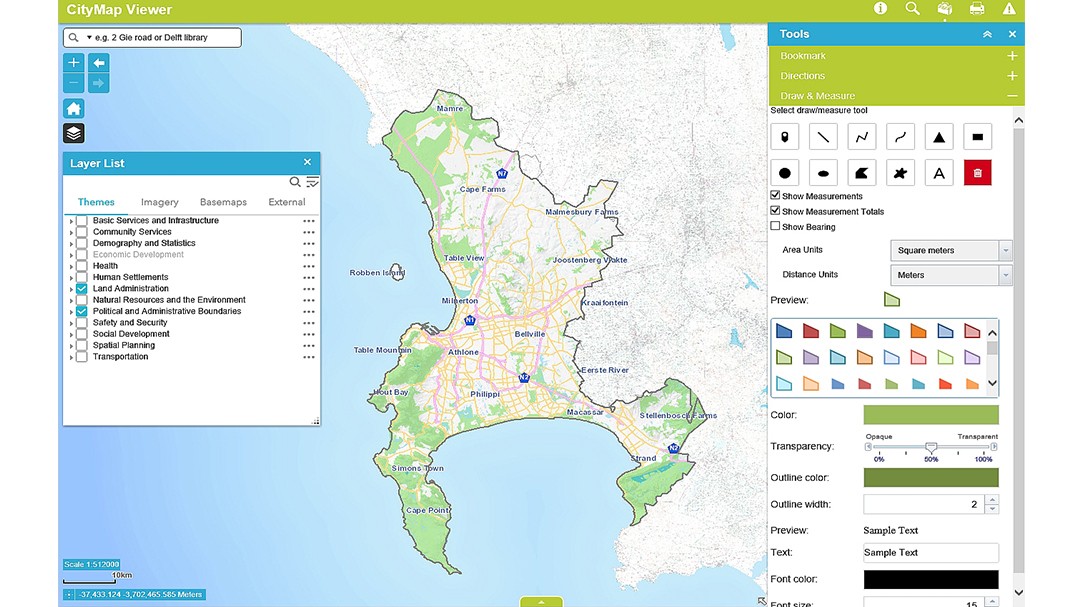 Magnificent mapper: The CityMap Viewer has a simple interface and powerful tools, and information is grouped in themed layers, which can provide highly detailed information.
 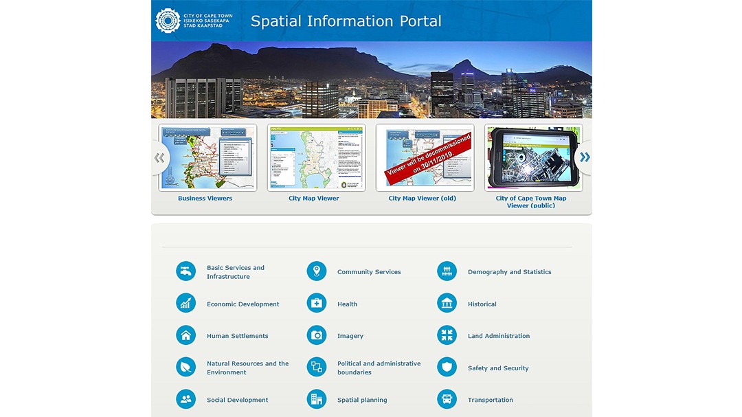 The spatial information portal, available to all City Staffers with access to a computer, is the gateway to vast quantities of carefully collated and curated data, covering almost every imaginable City activity.
The granular detail available with the tool is extremely precise. Every asset in the city—from a building to a single electricity pole or water meter—can be located and identified. The location data is also regularly updated via the available communications channels. For instance, when the Water and Sanitation department performs maintenance on a bulk water valve with a GPS-equipped valve exercising machine, the precise location of that valve is confirmed, and its service record updated in the system.
The spatial information is captured, managed, maintained, and analyzed by 360 GIS desktop users from various departments. For this process, users mainly utilize Esri’s ArcGIS software suite. Based in California, Esri is the world’s largest supplier of GIS software, with more than a million users in 200 countries.
Click the link to read full Article: User Story
This Article was reposted with permission from esri