The Floods are Back in the Capital City of Accra
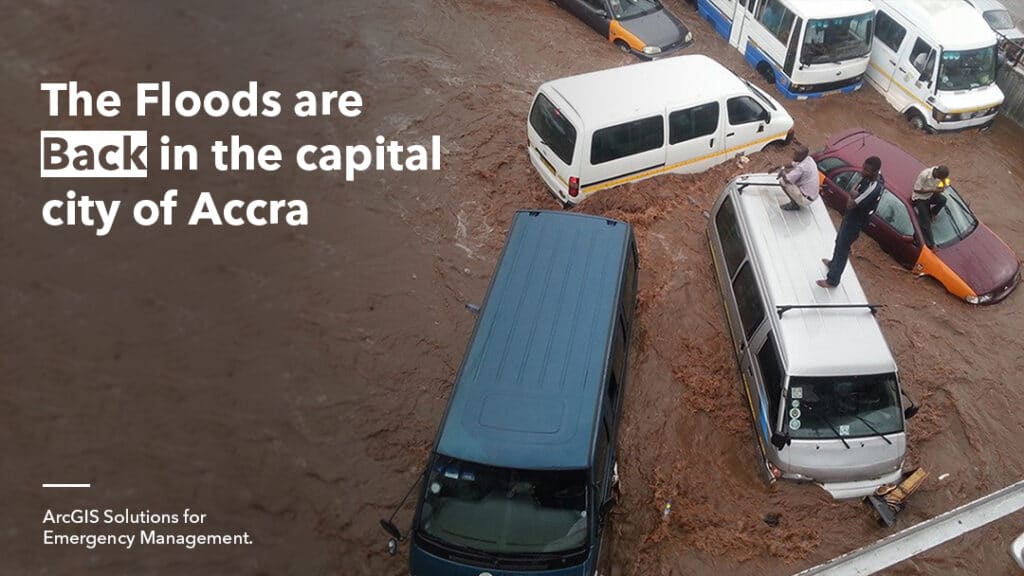
The Greater Accra Region has experienced a high rainfall record this year resulting in historic flooding in most parts of the region. The flood has destroyed homes and caused damage to roads, bridges, and other public infrastructure. Areas greatly affected include Kaneshie, Adabraka, Weija, Teshie, Kwame Nkrumah Circle, Dansoman, and Tesano. In Emergency situations such as this, ArcGIS Solutions for Emergency Management helps in reducing the impact of flood on the residents in the region.
ArcGIS Solutions for Emergency Management is a collection of customizable maps and apps for disaster and threat management. These Apps can be deployed to aid in emergency preparedness, risk mitigation, and coordinating response and rehabilitation. The apps are integrated with the ArcGIS system to provide situational awareness to support your objective.
During floods, ArcGIS for Emergency Management can be used to capture flooding status and show response teams and decision-makers who is affected, and the extent of damage caused by the flood. The solution also facilitates the distribution of threat alerts, notices about evacuation zones, routes, and service locations. This solution can also aid in the coordination of the activities of NADMO and other support and rescue teams.
Additionally, the solution can be used to collect feedback from affected individuals and businesses to estimate damage to residential facilities, businesses, and social amenities in communities. Data obtained can be used to help local governments track and identify vulnerable populations, communicate road closures, service failures, damaged structures, health and safety issues, and enable disaster victims and communities in general get the help they need.
Access Esri’s Disaster Response Program to learn more on how we support the local community in emergency situations.