Sharks and Accessibility in ArcGIS Pro
Setting the Stage
A couple of months ago my mom came to visit for spring break and since we were trying to squeeze the most out of some passes we had purchased last year, we all headed to Universal Studios. After standing in line for a couple of rides and walking around the park for a while, especially with “Gramma K”, taking the studio tour is a great way to rest while still seeing a lot. It’s one of those tours where you get on an open-air bus and are driven around old movie sets while the live narrator tells jokes that she has probably repeated hundreds of times.
Towards the end of the tour, the bus pulls up next to a dock by the Amity Hotel, everything gets quiet, and you hear the ominous music slowly rise – buuh buh… buuh buh… – and crescendo until a gigantic shark launches out of the water, splashing those who are closest, followed by the explosion of a dockside fuel pump (how a breaching shark causes a fuel pump to explode is beyond me, but hey, it’s Hollywood!), its heat helping to dry those who were splashed.
The best part of this whole story is that as I’m explaining to my now-terrified six-year-old son about the nearly 50-year-old movie, all I could think about is how Esri software supports screen readers just as JAWS and the other accessibility features that we’ve continually been adding to ArcGIS Pro over the years.
The Main Features
We recognize the importance of not only developing accessible software but also providing tools that help you craft more inclusive maps that are accessible to a wider audience. Below I’ll touch upon just a handful of key accessibility features available in ArcGIS Pro. Find more details in the Accessibility in ArcGIS Pro help topic.
Since we’re covering key features, I’ll mention a couple of my favorites when using ArcGIS Pro with a keyboard. You can select ribbon tabs and execute commands with access keys. Press the Alt key to enable access keys. KeyTips appear on the ribbon, showing which access key or keys to press. When you press a key to select a tab, additional KeyTips appear for the commands on that tab. Leverage this functionality to quickly launch commands you’ve added to the Quick Access Toolbar by hitting Alt and then the number of the command. Of course, you can use keyboard shortcuts directly, and customize them, but how many shortcuts can you actually remember? Using Alt keytips provides a great visual navigation guide to commands while reducing mouse travel.

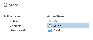
The second keyboard-focused functionality I want to highlight is using Ctrl+Tab or Alt+F7 to switch among panes and views. Press either of those key combinations to open a window that allows you to change the active pane or view. Use the arrow keys to move among views and panes.
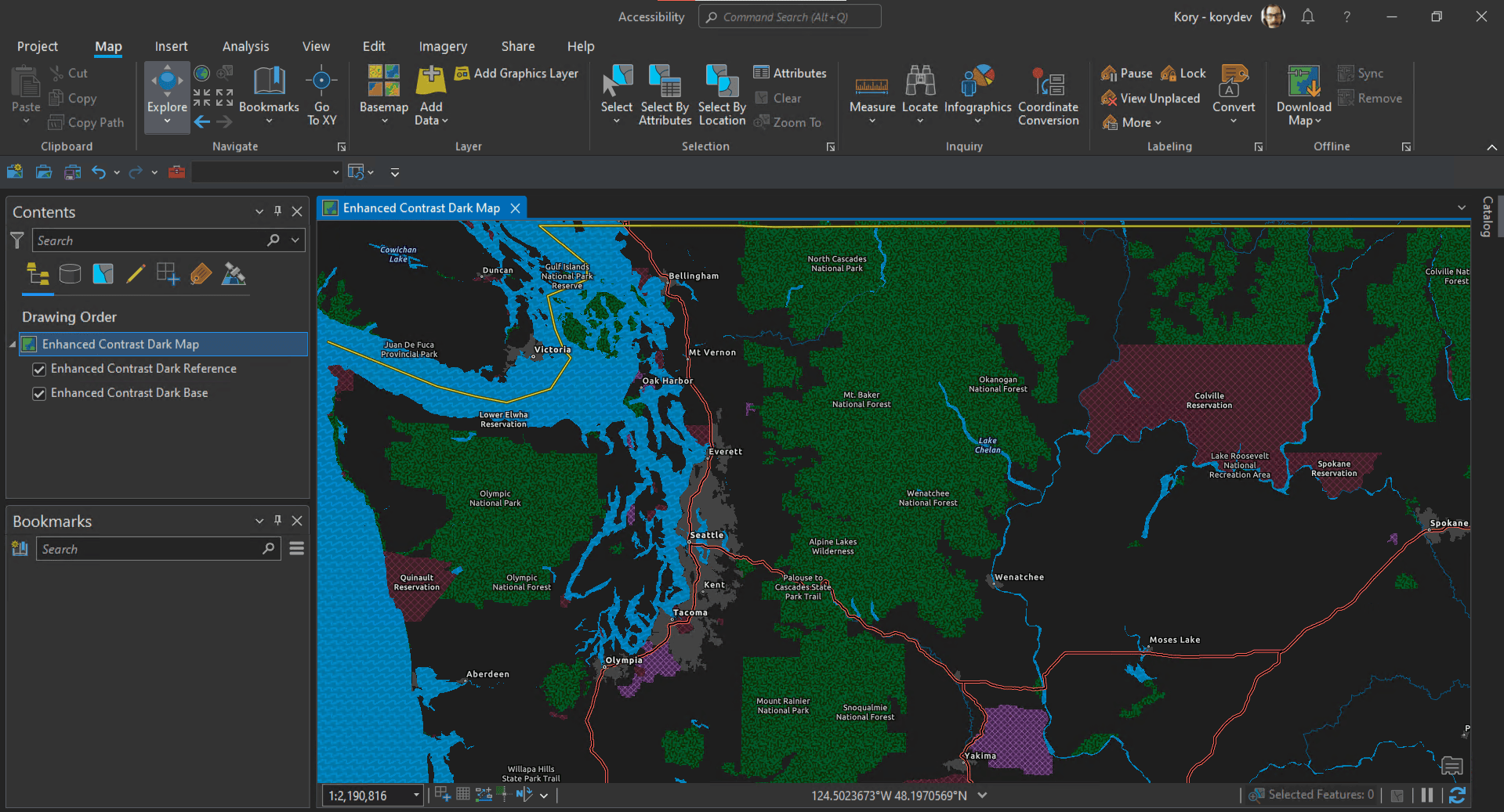
Now that we’ve covered some core keyboard functionality, let’s move on to the most popular visual mode of operation in ArcGIS Pro, dark theme. What can I say, people love dark themes. Feel the love in this post, “I showed my students Dark mode today; they thought that’s pretty cool.”
Another important feature to help ArcGIS Pro users is User interface scaling which allows you to increase the size of the text, icons, and other UI components, making them easier to see. The interface can be scaled up to 200 percent of the default size.
If you’re having trouble discerning features in default base maps, try the recently released Enhanced Contrast Map or Enhanced Contrast Dark Map.
Here is an example that brings together the above three features to show ArcGIS Pro in a dark theme, with user interface scaling set to 130% and the Enhanced Contrast Dark Map added to a map view.
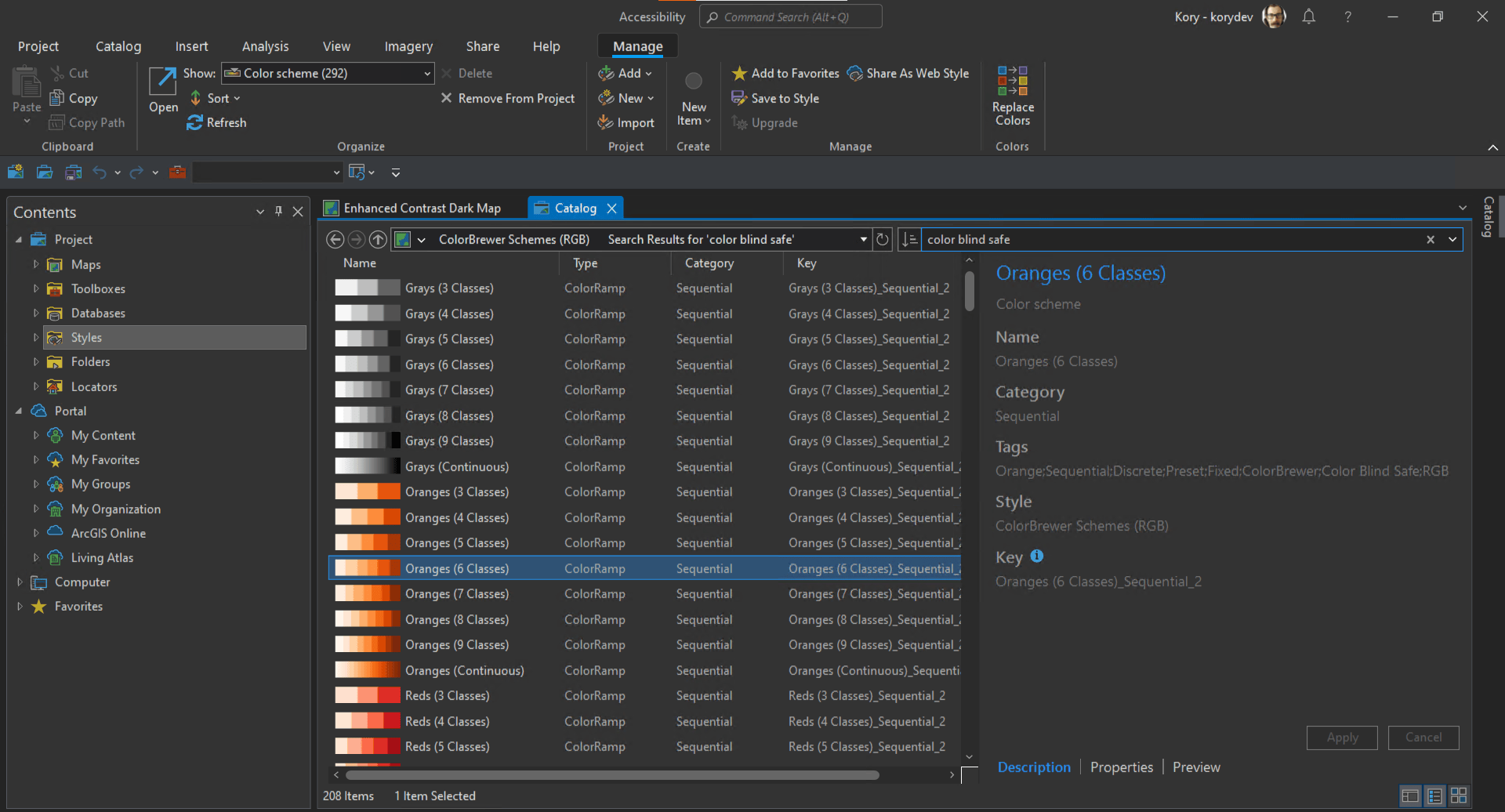
Now that you’re set up to visualize your own data, note that ArcGIS Pro comes with the ColorBrewer Schemes style. Many of the color schemes included in the ColorBrewer Schemes style are color-blind safe. You can search and find these color schemes from the style’s search bar in the catalog view. Open the style in the view, and search for the “color-blind safe” tag.
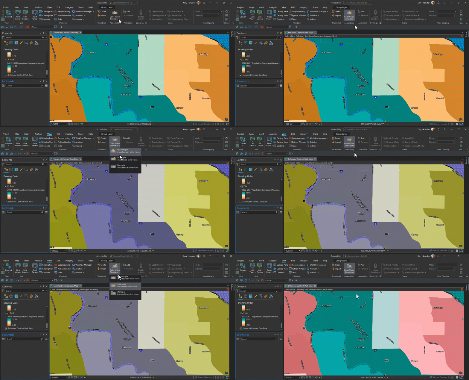
As you prepare your map’s symbology, use the color vision deficiency simulator tool to simulate how your map, layout, or report will appear to someone who has a color vision deficiency, sometimes referred to as color blindness. The tool has three simulation modes: protanopia (color blindness to red), deuteranopia (color blindness to green), and tritanopia (color blindness to blue).
When you are ready to export your layout, don’t overlook the Accessibility tab which contains options for writing a tagged PDF document, which can be read by screen readers or other assistive technology (remember JAWS?). Including alt text in your PDF exports allows more people to access your ArcGIS Pro map products.
Accessibility at the User Conference
If you are attending the User Conference in July and are interested in learning more, plan on attending the ArcGIS Pro: Accessibility demo theater or come visit the dedicated Accessibility kiosk in the Installation, Authorization, Globalization, and Accessibility showcase area. (Use this map https://uc2023.esri.com/eventmaps/map.html)
For ArcMap Users
Much of what I’ve touched upon here is functionality that was not available in ArcMap. Remember that ArcGIS 10.8.2 is the current release of ArcGIS Desktop and will enter Mature Support in March 2024. There are no plans to release an ArcGIS Desktop 10.9, and it is recommended that you migrate to ArcGIS Pro. See Migrate from ArcMap to ArcGIS Pro for more information.
Additional Resources
Banner photo by Croyde Bay on Unsplash
