GIS Data Governance Is Key to OETC’s Success
Oman Electricity Transmission Company (OETC) was formed in May 2005. Until then, the Ministry of Housing, Water, and Electricity managed all aspects of Oman’s power supply. OETC’s mission is to transmit electricity, finance, develop, operate, and maintain its electric transmission grid. In addition, OETC develops and operates a system of central dispatch of generation facilities that are connected to the grid. OETC also owns, operates, and maintains international grid interconnections. The main electricity transmission network operates at 132 kV and above. OETC also balances generation and demand at all times of the day for the economic dispatch of power in the Sultanate.
Challenge
Within OETC, there is a consensus across the enterprise that geographic information system (GIS) technology is a critical tool for many workflows. However, concerns were raised in 2017 about the accuracy of its GIS data. At the heart of this concern was the process of data gathering. OETC management raised three points:
- The GIS database was incomplete and contained inaccurate asset information. However, no one could accurately determine the extent.
- Inaccurate and incomplete data limited the use of GIS.
- One of the most concerning risk sources associated with inaccurate GIS data was the lack of a governance process for data updates.
“Without a reliable data governance process in place, we wouldn’t be able to leverage the capabilities of our GIS. Now we can.” Khalil Al Shukaili, Asset Information and GIS Manager, Asset Management, OETC
An extensive audit was performed on the data governance process. The audit illustrated a lack of consistency in data management, updating, and handling. In addition, the audit illustrated a lack of conformance with a solid asset management process as defined in ISO-55001. Since GIS is a critical tool for asset management, planning, design, and engineering and the No Objection Certificate (NOC) safety process, a plan of action was required. A NOC is issued by the government to indicate that there are no objections to an entity digging in a designated area. However, digging in an area with potentially underground equipment, such as electrical lines, is a critical safety concern.
The following tables are used to measure the risks associated with incomplete and inaccurate data. These provide a framework for the data governance process.
 Likelihood Criteria
 Risk Assessment Matrix
Solution
Because of the data inaccuracy and incompleteness and internal audit observations, OETC held a series of meetings with concerned departments to identify the important attributes for critical assets. As a result, the consensus was that a formalized data governance process for the critical GIS was needed.
What Is Data Governance?
The data governance update process refers to the policies, procedures, and controls put in place to ensure the accuracy, completeness, and timeliness of data updates in an organization. Updating data involves adding, modifying, or deleting information from the system or database. It is essential to have a well-defined process governance framework in place to maintain data integrity. OETC implemented the following framework.
While building the data governance process, OETC identified gaps in the data management process, established strict rules for data movement from its source to the GIS, and continued monitoring compliance. The initial focus was on the completeness and accuracy of seven critical assets and their attributes. The assets that were identified were power transformers, circuit breakers, potential and current transformers, arresters, overhead lines, underground lines, and bus bars. As the process unfolded, more assets were added to the data governance process.
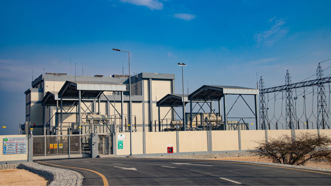
 OETC’s 400/132 kV Grid Station
The team identified nine checkpoints, or gates, for the stages of projects. At each gate, the team decides whether to continue the project. OETC evaluates critical data created or modified at each gate. This exercise is a critical component of the GIS data governance process. The nine gates are as follows:
1. Confirm needs, risks, and solution options.
2. Approve project appraisal.
3. Review investment.
4. Approve consultant brief.
5. Develop tender.
6. Approve the design and proceed to construction.
7. Accept commissioning and energization.
8. Perform post-energization and takeover
9. Approve project completion.
Results
A key result of the implemented GIS data governance process was the ability to measure the accuracy and completeness of the data. Once measured, the company could then track improvement over time. The measurements were based on the results of four tasks:
• Automated quality checks
• Physical data checks
• Spatial reference checks
• Positional accuracy checks
Data has improved dramatically since the implementation of the data governance process. From the outset of the process, geodatabase completeness has increased from 57 percent to 75 percent, with greater improvements expected.
 OETC’s Modern Indoor Transmission Substation
Benefits
The benefits have resulted in an expansion of the use of GIS. It has become an essential tool for many more practices and activities within OETC than before the data governance process implementation. Integrating the GIS and OETC’s computerized maintenance management system (CMMS) has increased both systems’ effectiveness and completeness. Integration readiness is now possible between SCADA, our Online Condition Management System, and Fixed Asset Register corporate systems.

Now that GIS is playing a larger role due to increased confidence in the data, its use in the following activities has increased significantly:
• Planning
• Capability studies
• Further grid expansion
• Maintenance planning
• Regular reporting
Next Steps
The GIS teams are formulating plans to move to ArcGIS Utility Network. Now that the data is on a steady improvement trajectory, moving to ArcGIS Utility Network will accelerate the increase in data quality. In addition, the company currently uses spreadsheets to track the data quality improvement process. It is now considering leveraging ArcGIS Dashboards for data quality tracking to discover where data quality gaps occur in the transmission systems.
“By implementing effective governance processes, organizations can ensure that their GIS data is an asset rather than a liability.”
Rahma Saleh Al Balushi
GIS Specialist OETC
