Ras Al-Khaimah Is the First in the Middle East to Implement Parcel Fabric
Ras Al-Khaimah has stood since ancient times at one of the most trafficked maritime crossroads in the Middle East, positioned between the Arabian Gulf and the Gulf of Oman. In addition to being a vibrant trade center, this rising star of the United Arab Emirates is attracting investors and developers who recognize the municipality for offering a modern quality of life at an affordable price.
Construction has surged in recent years, bringing residential, industrial, commercial properties, and leisure development to the emirate. Planners wanted to ensure that technology systems for recording and maintaining land records—which protect developers, buyers, and sellers—evolve at the same pace. This created an opportunity to take a more modern approach to managing land records.
By consolidating its work in a single geographic information system (GIS), the emirate’s planning team knew it could improve the quality and accuracy of land records. In addition, the government could improve customer service. With the dynamic digital maps and advanced data analysis capabilities that GIS technology provides, town officials would also gain important tools for planning the future with an eye toward sustainability.
Challenge
The Ras Al-Khaimah GIS Center team used a combination of software applications along with manual processes to carry out the work of recording and documenting the location and features of properties within the Emirate. Yet, the town’s processes for managing land records were not quite seamless. Teams in the planning and GIS departments had to resolve complex challenges to ensure land records were accurate.
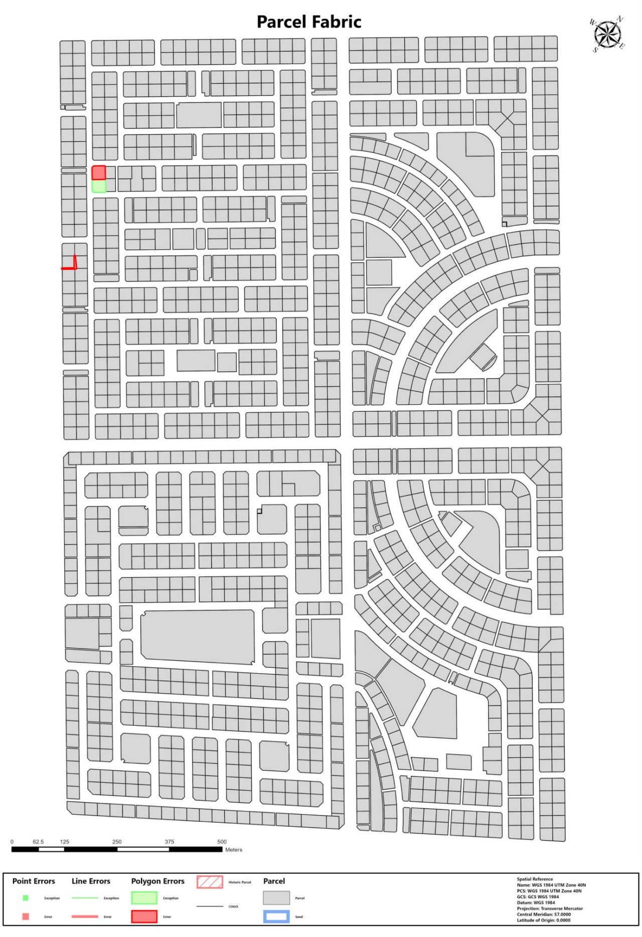
 ArcGIS Parcel Fabric provides tools for creating and maintaining a registry of land records. The registry called a parcel fabric, identifies properties by location using maps as shown here. The registry lists details about each property, its owners, and land transactions such as sales and purchases.
Property identification numbers and other information about each parcel of land are necessary for legal records such as site plans, plot title deeds, and land survey records. Issues that needed to be addressed to provide the necessary information included:
- Improving accuracy to distinguish the features of individual and neighboring parcels.
- Quality control over records that identify the size and other features of land parcels was performed manually. This led to errors such as discrepancies over the number of square meters listed to describe the property.
- The data management system did not have a way to designate the right of way, which created data quality issues.
- Property boundaries were not being captured, therefore linear measurements were unavailable.
Solution
To improve the quality of land records, the GIS Center began modernizing using Esri’s ArcGIS Parcel Fabric solution. This technology allowed planners to create a registry, known as a parcel fabric, that forms the basis of the system for managing land records.
Ras Al-Khaimah’s GIS Center set five priorities as it established its new registry:
- Create and manage a unified parcel fabric
- Improve the accuracy of land records
- Document and standardize operating procedures
- Transfer existing land and parcel data and records into the parcel fabric
- Train GIS Center staff to use and maintain the parcel fabric
The GIS Center used Esri’s ArcGIS Pro Advanced software to set up the system, which includes tools for tracking and managing parcel history. The system also includes automation for validating parcel data. Edits made to the parcel data become linked to a business record.
Highly reliable coordinate geometry is used to locate and measure land parcels and features such as roads and utility easements. The parcel fabric includes additional features for validating data based on topologies. This helps to identify boundaries by eliminating gaps and overlaps at adjoining properties.
ArcGIS Enterprise software adds capabilities for creating multiple versions of land records in a multi-editor environment. Users also can manage access to the system and publish parcel data to the web and mobile applications.
 The emirate of Ras Al-Khaimah created a registry, called a parcel fabric, to improve the accuracy and completeness of data about properties in the municipality. With a digital registry created with ArcGIS Parcel Fabric software, the records are easier to maintain and share.
Results
With a single technology system for managing parcel data, engineers, and GIS experts with Ras Al-Khaimah have successfully improved the accuracy of the emirate’s land records while making operations more efficient. For example, the right of way is now identified as a parcel type, allowing analysts to designate land for infrastructure such as roads and utilities. Automation has reduced the time needed for manual tasks such as editing and updating parcel profiles, known as histories.
The system also adds efficiency by linking new parcels to a case identification number that town planners and the public can use when transacting against the property. Search capability enables users to determine a parcel’s owner and the current land use category. They also can see a history of transactions.
Automation is also improving quality control. For example, processes for evaluating spatial relationships and validating non-spatial attribute data are now automatic.
By improving the accuracy and availability of parcel data, officials in Ras Al-Khaimah are ensuring that the investments landowners make will be better protected. At the same time, a more complete and reliable parcel fabric gives data analysts a valuable resource for recognizing trends and patterns and detecting change over time. With a deeper understanding of growth and change, as it takes shape, planners are more equipped to map Ras Al-Khaimah’s future.