MAJANCO LEAPS INTO MOBILE GIS TECHNOLOGY
Majan Electricity Company (Majanco) serves nearly 296,000 electric customers in the Al Batinah North, Al Dhahirah, Al Buraimi, and Musandam Governorates in the Sultanate of Oman. Headquartered in the ancient port city of Sohar, Majanco is ideally positioned to serve one of Oman’s fastest-growing regions. Moreover, the port of Sohar is one of the most strategic in the region due to its proximity to the Strait of Hormuz. As a result, the government of Oman is working closely with the region to create a business center focusing on the diversification of the economy.
Majanco was founded in 2005 after the privatization of the Ministry of Housing, Water, and Electricity.
Challenge
Majanco’s electric service territory spans the northeastern coast of Oman, where the average annual rainfall is less than four inches. In addition, the temperatures during the fall are typically higher than 100 degrees F. This dry and hot climate causes the land to be virtually impervious to water infiltration. Then something happened in early October 2021. An unprecedented weather event hit Majanco’s service territory. Cyclone Shaheen slammed into the northeast coast of Oman, bringing winds of over 100 miles per hour, creating unprecedented damage to the ground infrastructure, including the electric network and customer meters.
Majanco had been building a comprehensive geographic information system (GIS) infrastructure for quite some time. However, it continued to produce paper maps for field use. Given the lack of significant weather events, the field maps were adequate for most routine work. That is until Cyclone Shaheen struck. It delivered more rainfall in one day than the region normally receives in one year. Crews could not navigate damaged areas due to street flooding, collapsed buildings, and massive power failures. There was a sense of confusion for the field staff. The paper maps could not provide the rapid response needed to assess the damage, locate assets, and determine where network connectivity was disrupted.
“We quickly realized that we had to deploy GIS mobility technology to solve the severe problems created by Cyclone Shaheen.”
—Saif Al Rawahi, GIS Manager at Majanco
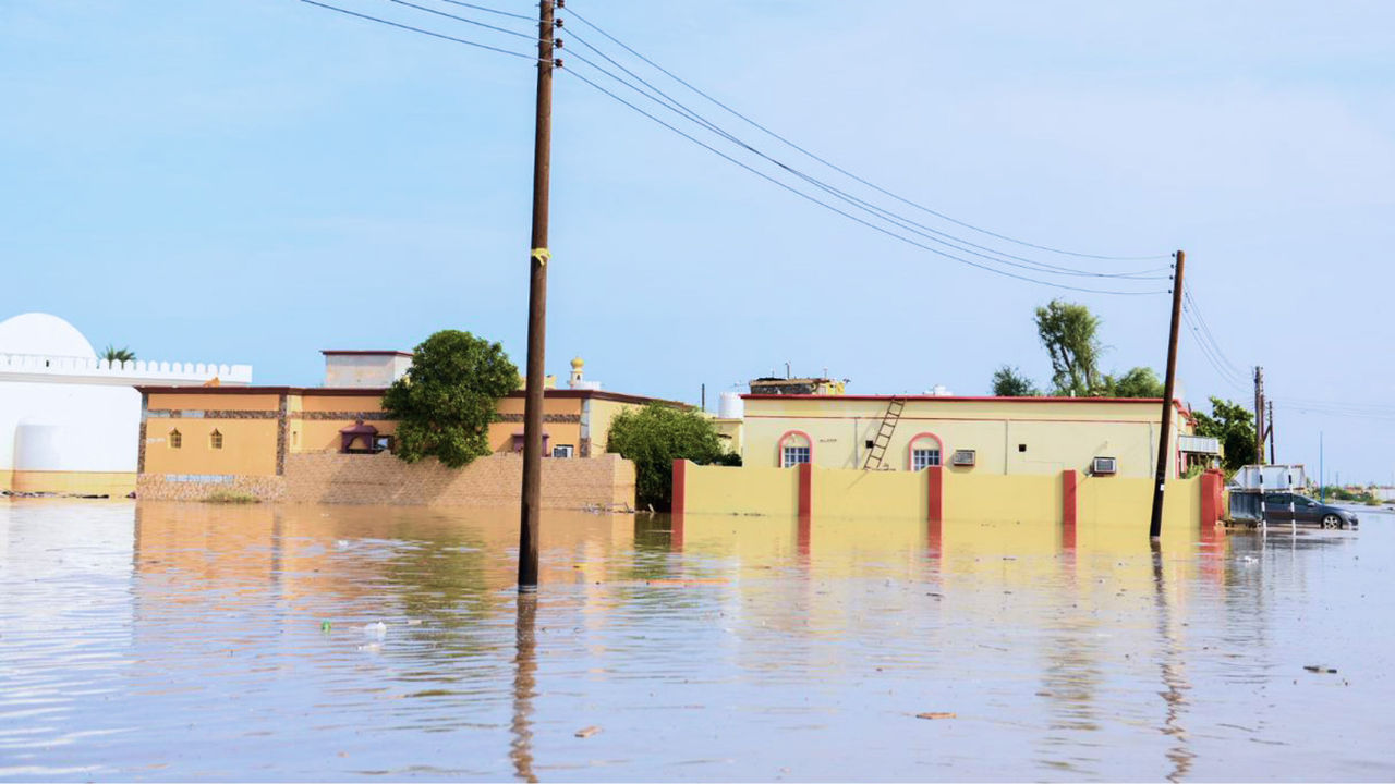 Rains flooded streets leaving electrical crews unable to serve customers.
Solution
Fortunately, Majanco had a fully functioning GIS with excellent data quality. However, it quickly became clear to the GIS team members that they needed to add mobile capability to their GIS for rapid damage assessment and analytics. And quickly, they turned to two field apps for the job. The first mobile application was ArcGIS Explorer, whose functionalities have recently been combined with ArcGIS Collector into ArcGIS Field Maps. Crews needed up-to-date digital maps on their mobile devices to get a full view of the network, particularly from customer meters to the supplying transformers. The flood waters and high winds heavily damaged the walls to which the meters were attached. The field maps guided the crews to ensure accurate meter connectivity. The GIS team deployed the technology within hours of the storm’s devastating strike.
The team members also deployed ArcGIS Survey123, primarily for damage assessment and inspection. Again, they were able to deploy this technology quickly. The ease of form creation allowed the field forces—many of whom had never used GIS technology— to accurately capture data on damaged areas.
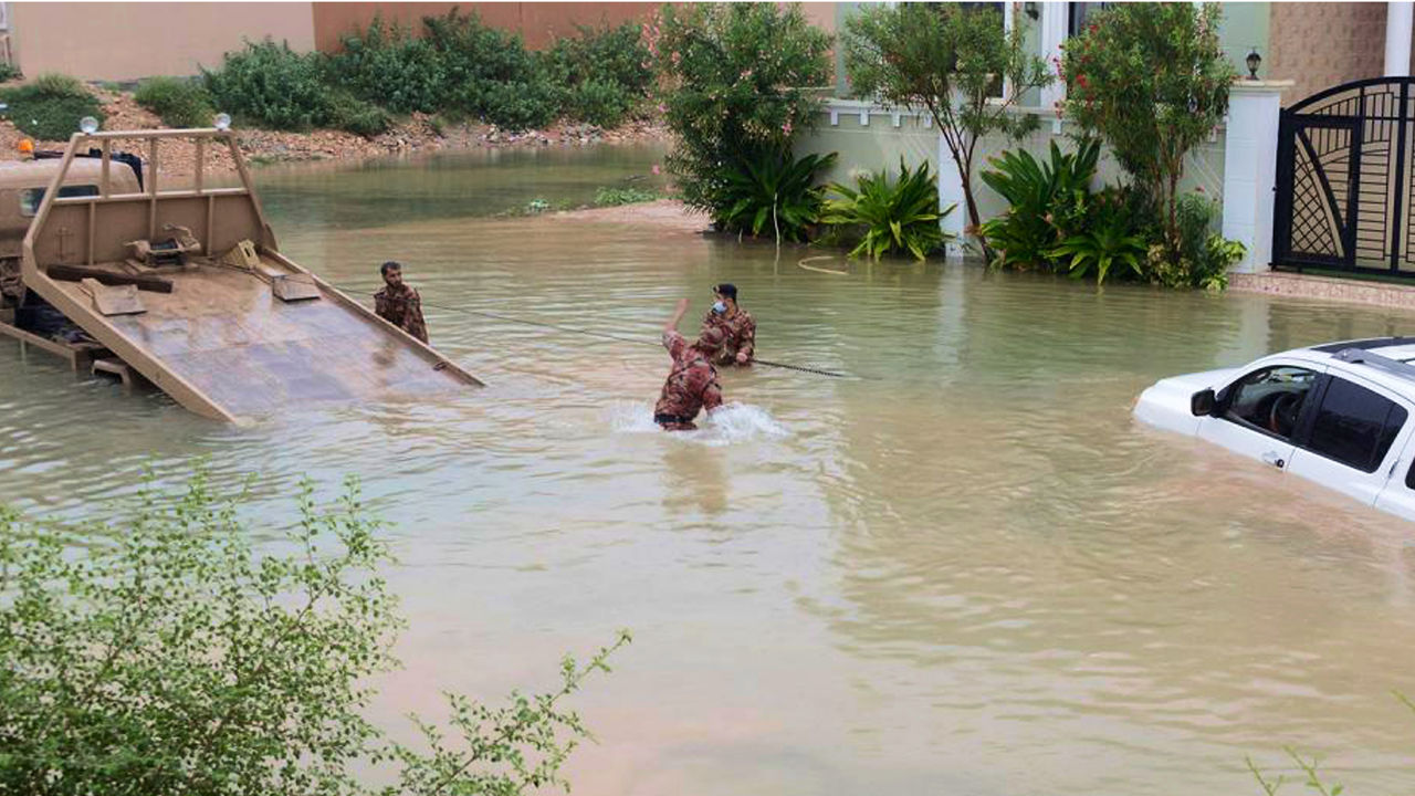 High winds and heavy rain created confusion and havoc.
Result
In the past, crews had to capture data on soggy and out-of-date forms then bring these to the office for analysis, which was time-consuming. The forms were hard to read, and office staff would struggle to interpret spreadsheets for analysis. Using ArcGIS Survey123, the updates were automatically generated from the field, and processing time was reduced from hours to minutes. The result was that all levels of management, from field managers to corporate management, were continually updated on restoration and damage assessment progress.
Without this critical technology, restoration would have been delayed for days.
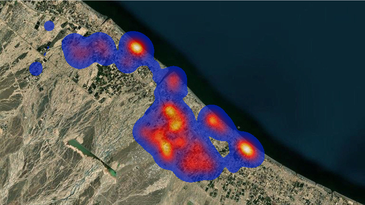 Above is a heat map of the damage meters.
Benefit
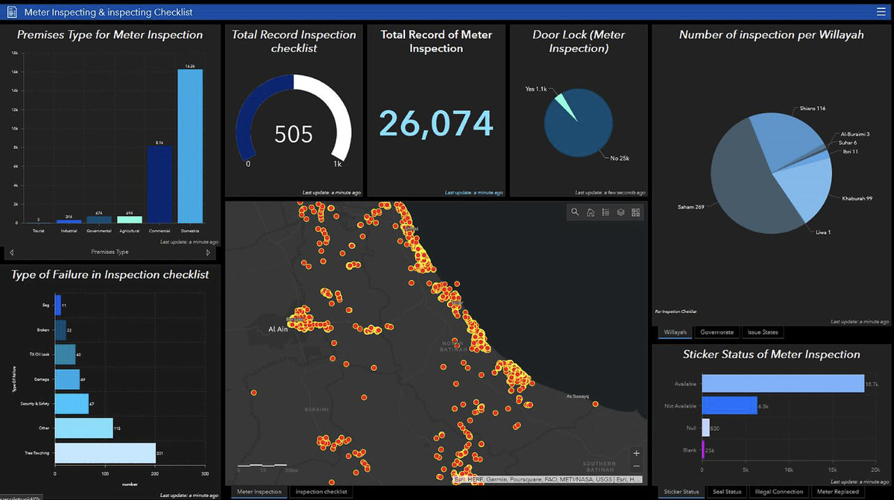
Once the storm passed, repairs were made, and life was restored to normal in Sohar and the surrounding areas, Majanco team members thoroughly assessed the mobile technology. They discovered that while the mobile capability of ArcGIS served them extremely well during the critical early days of Cyclone Shaheen, the technology could also substantially benefit normal operations. As a result, they continued using ArcGIS Dashboards and mobile technology. They discovered that the mobility technology helped to find data errors that might have been missed on the paper maps. In addition, they used mobility technology to help with workforce mobilization. Now that the GIS had mobile capability, analytics became readily available. For example, one of the issues the company faced was locating meters. The technology improved this process substantially, using ArcGIS Survey123 app’s ease of mapping, inspection, and forms creation capability. Another example was deploying Esri ArcGIS QuickCapture to improve maintenance activities of the electricity network assets and monitor unsafe conditions as shown below.
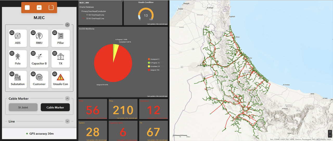 ArcGIS QuickCapture and a dashboard are used to monitor unsafe conditions reported by the field staff.
The dashboards helped craft comprehensive analytics to improve nearly all aspects of their operations, including design and engineering, asset management, and operations management.
“Once the storm passed, we deployed the GIS mobility technology to improve many of our operating processes.”
-Saif Al Rawahi, GIS Manager at Majanco
 Majanco continued the use of analytics as part of its normal business.
The GIS team members also discovered that adding mobile technology to their GIS was relatively straightforward and took much less time than they believed. And it came at the right time. In fact, the many difficulties the storm presented provided the impetus for Majanco to leap into mobile technology. And the company and its customers will continue to receive benefits going forward.