Flood Inundation Modelling
Background:
A flood occurs when water overflows and submerges onto usually dry land. Flooding is often thought of as a result of meteorological events such as heavy rainfall. However, floods can arise in a number of ways that are not directly related to ongoing weather events. Research shows that floods originated ultimately from an atmospheric process creating precipitation, notwithstanding what specific event causes the flooding.
Flooding is a global phenomenon that causes casualties and property loss on every populated continent. It’s probably the most critical devastating, pervasive and recurrent human natural disaster that requires intense attention to its course. An example of flood damage is typically the release of suspended silt and potentially toxic microorganisms and dissolved chemicals that usually compromise drinking water supplies for the residents of a flooded area.
On the other hand, the effect of the floods is not always negative as it is part of the natural cycle and can have significant environmental and social benefits, especially in areas where it has suffered from severe drought. Periodic flood-scouring events are also crucial for most riverine areas and coastlands habitats.
Flood Modelling
While some of these outcomes are relatively not easy to track, attempts have been made to understand, evaluate, and forecast flood events and their effects throughout human history. Flood inundation models are therefore being built to serve this purpose. As floods account for a large proportion of the total number of recorded natural disasters occurring globally, and this proportion has risen over the last 30 years (Freer et al., 2011), the production and implementation of risk flood models and related research have become a reality.
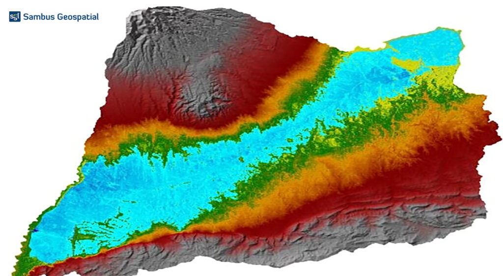
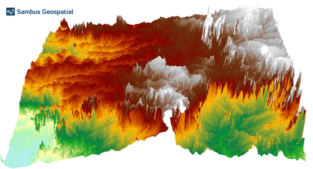
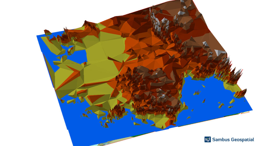
Methods Applied
Download a digital elevation model -DEM from USGS, and convert the DEM to TIN using 3D Analyst toolbox. Bring both data into ArcSec workspace, and a raster water body will be overlayed with relevant height values to generate the flood inundation.
See the image below for outcomes.
SOFTWARE: Arc Scene 10.8.1, Arcmap 10.8.1. DATA SOURCE: USGS
Project by Tesini P. Dombo & Bamidele Clement Oke
For more information, send mail to info@sambusgeospatial.com.