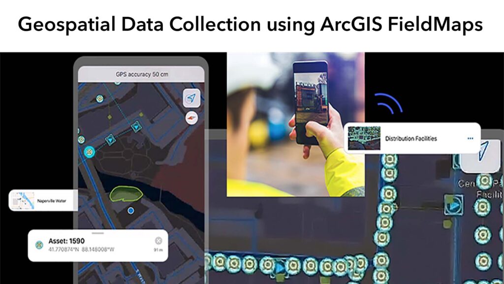
Geospatial Data Collection using ArcGIS FieldMaps
GEOSPATIAL DATA CREATION
The traditional methods of generating spatial data in on the field have been restricted, but recent technological advancements have broadened the range of options for generating spatial data. The use of global positioning system (GPS) receivers is the most popular method of collecting geospatial data. A dedicated GPS unit that communicates with a constellation of satellites to measure the location of the GPS unit on the earth’s surface can be used to collect GPS data. Apart from recreational and scientific-grade GPS units from companies including Garmin and Trimble, GPS data collection can also be done on many smartphones, laptops, and other mobile devices that have a GPS receiver and can use the same satellite network to determine location.
Though GPS data collection allows for geospatial data to be generated in the field, much spatial data is generated without ever leaving the device. Geocoding is a crucial step in creating spatial data for public health. The process of translating addresses into geographic coordinates, which can then be stored in a GIS database and mapped, is known as geocoding. Many GIS software systems provide street address reference databases for in-person geocoding, but online resources can also translate batches of addresses to spatial x- and y-coordinates. Health observations are geocoded at a smaller geographic scale in certain situations, such as the neighborhood, zip/postal code, or state/province level.
In this research, we will look at how flexible it is to configure and make use of the ArcGIS Field Map and Application using Mobile devices.
Field Workflows Streamline
The ArcGIS Field Map Replaces paper processes and disparate tools to bring efficiency to fieldwork with a single app that can be configured for the specific workflows of your field workforce. Fieldworkers have the preconfigured field maps and forms they need on their mobile devices to complete their work efficiently and accurately.
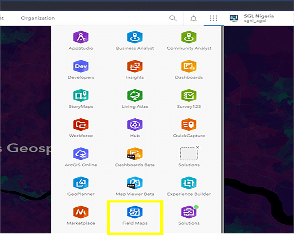
The ArcGIS Field app is accessed via the ArcGIS online Application drawer, as highlighted in Figure 1, to Launch the app.
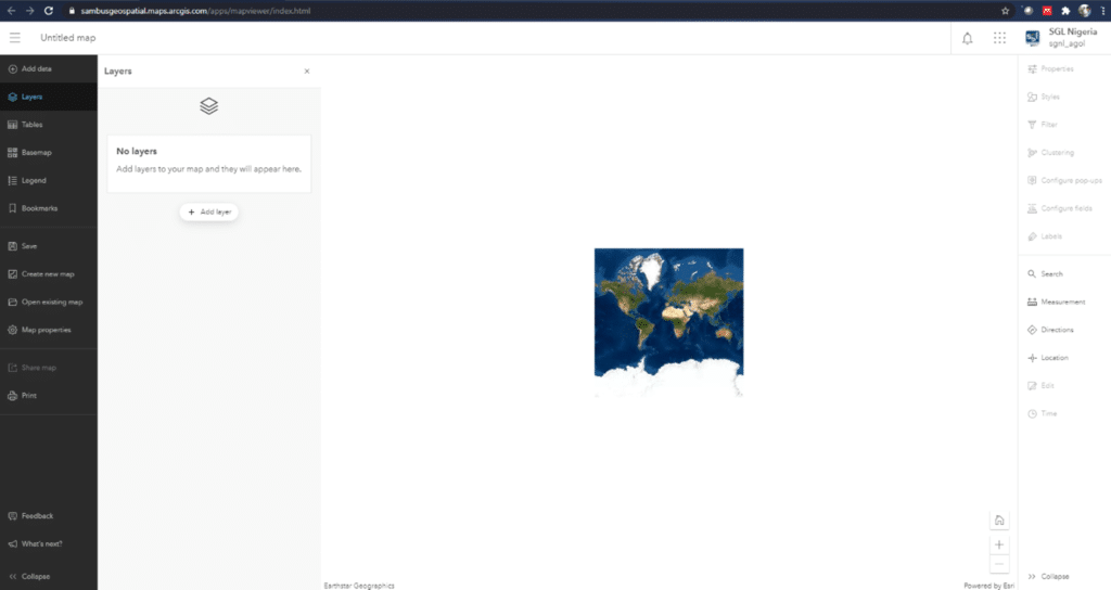
When the Application is launched, a new page for map configurations and manipulation is created where forms and field maps can be added and configured Figure 2.
Create
Forms are created and configured for the field maps to support the specified field workflows whenever work is done, including offline or indoor capability, as seen in figure 3

Collect
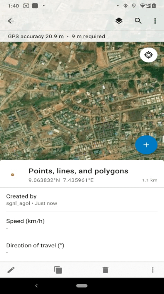
Map driven forms fuel the ArcGIS Field Maps mobile app for data capture and editing, recording and reporting notes, and completing workflows. The designed map is used on any mobile device with the correct specification, as seen in figure 4.
Track
The ArcGIS Field Map Location tracking supports greater situational awareness for field supervisors and improves transparency between the office and the field.
Data Visualization
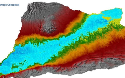
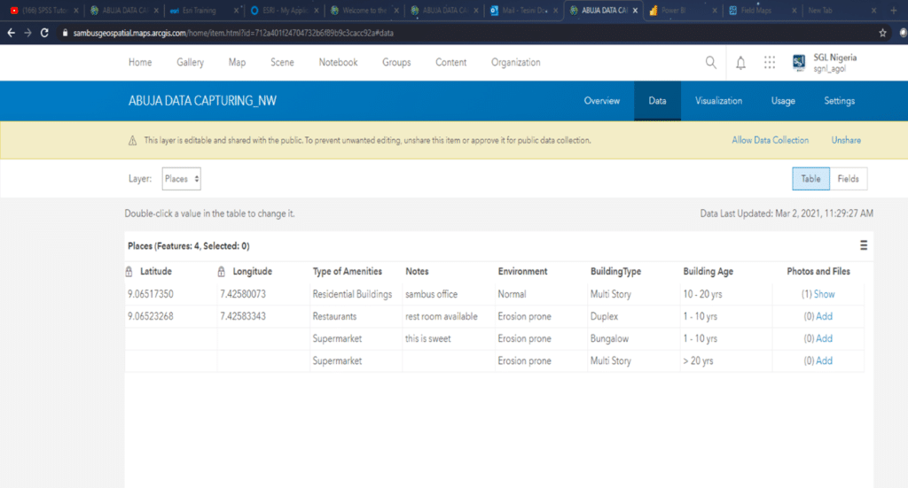
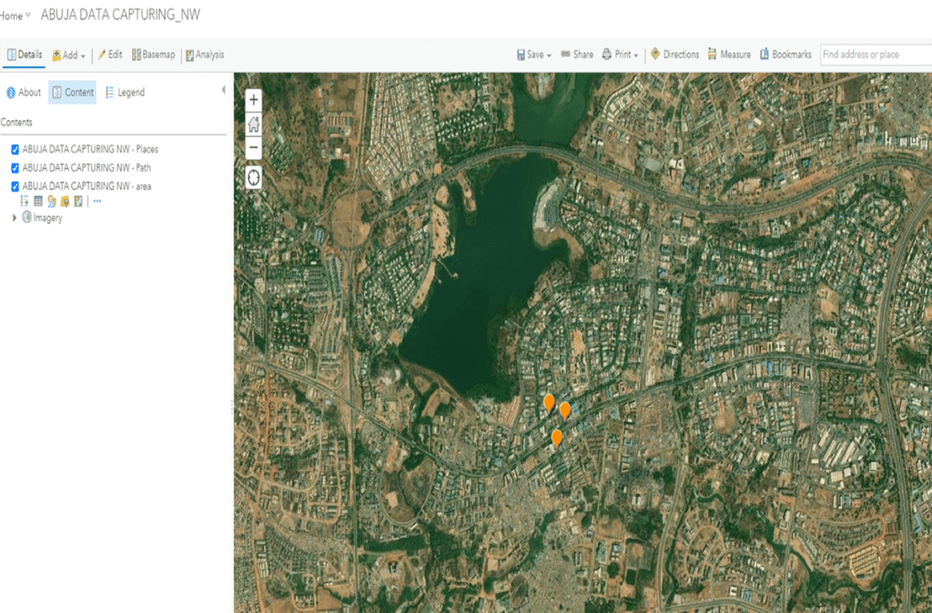
Geospatial Data collected from the field is readily visualized on the ArcGIS Online platform, as seen in Figures 5 and 6. The data can be readily edited, and tables can also be visualized. The data and their location can also be visualized on the map tab of ArcGIS online when the package is launched.
SOFTWARE: ArcGIS Field Map/ App, ArcGIS Online, ArcGIS Pro 2.7, Mobile Device – Nokia 6.1
Project by Tesini Precious Dombo.
For more information, send mail to info@sambusgeospatial.com.