Saving Our Forests With GIS
Geographic Information systems – GIS is a framework for gathering, storing, analyzing, and displaying spatially referenced data.
GIS has improved forest inventory data thus enabling foresters to improve forest conditions, plan adequately for the short and long term, estimate the growth of forests, calculate wildlife population, discover forest species, assess potential hazards such as forest fires, and discover non-timber products in the forest among others.
The resources in the forest are so numerous and particularly precious such that managing them is crucial to ensure sustainability. However, the Nigerian scenario brings into limelight how adverse anthropogenic activities in the country easily puts at least 899 species of birds, 274 mammals, 154 reptiles, 53 amphibians, and 4,715 species of higher plants at risk; considering that the country’s forests are significantly threatened due to logging, industrial cum agricultural decimation, conversion for subsistence, annual bush burning, and high population growth rate. This, therefore, necessitates the need to apply GIS for the effective management of forests and forest resources.
According to a report, as of late 2012, nearly half of Nigeria is forested but the country’s rainforests are fast declining. According to the U.N., Nigeria lost nearly 80 percent of its old-growth forests between 1990 and 2005, giving the distinction of having the highest deforestation rate of natural forest on the planet during that period.
Sambus Geospatial Limited being a major advocate of usage of GIS interface towards providing geospatial solutions along multisectoral boards stands tall in the drive towards ensuring environmental sustainability in all areas including forestry.
Areas of the relevance of GIS include but not limited to the following areas:
Fighting forest fires.
Land reclamation.
Species identification, verification, and management.
Preservation of endangered species.
Route tracking and management.
Security set up forestalling encroachment.
Fighting Forest Fires
While forest fires in some regions of the world like California in the united states and Australia are largely natural, the case of forest fire in Nigeria is anthropogenic basically. This is a major headache especially for people who live and have their homes built on the fringes of the forests as they have had their properties burnt inadvertently, all because some persons were hunting for a game (bushmeat as it is called in local parlance) or as a means of forest clearing for farming purposes; not to mention the untold damage to the ecosystem. With GIS, boundaries of the forest can be easily delineated such that buffer zones exist for the purpose of keeping intruders away. In addition to this, the areas where fire incidents have occurred over the years can be easily mapped such that much attention is given to such areas.
Reclamation of Forest Lands
Nigeria has launched and plugged into several laudable initiatives to address matters of drought and desertification, an example being the Great Green Wall initiative which aims at restoring the Sahel region while actively fighting desertification. However, It goes without saying that what is unknown cannot be reclaimed so the question is to what extent are the forest lands of Nigeria known? In addition to this is the question of what resources exist in each forest and how can they possibly be sustainably exploited? The answers exist in the field of GIS where databases can be built for the forests having performed a spatial analysis to determine what used to be forest as against what exists now viz a vis the available resources that exist in the forests to the extent that tourist interests can be generated, and the national Gross Domestic Product of Nigeria diversified as a result of this as against the single oil-based economy which is not sustainable in the long run.
Species Identification, Verification, and Management
The beauty of the forest lies in its fantastic array of plant and animal life. Therefore, the pattern of flora and fauna available within the forests can be geospatially identified, old claims and reports verified, and the databases built for this purpose can be effectively managed through the engagement of GIS. One of the implications is that if there be tourist interests in forest resources, the database will inform which areas are safe to be visited and what level of aid will be required during such visits.
Preservation of Endangered Species
While nature has bestowed Nigeria with extensive forests replete with plant and animal life, the level of poaching has been equally extensive, and damage done is huge to the extent that some plants and animals are now endangered which stands to reason owing to unsustainable practices of harvesting without corresponding replacements. According to a report, it is estimated that half a million tonnes of bushmeat are killed in Nigeria every year. Imagine that level of destruction! GIS as a tool in this context proves important as it helps to identify endangered species and aids decision-making over how to go about protecting them.
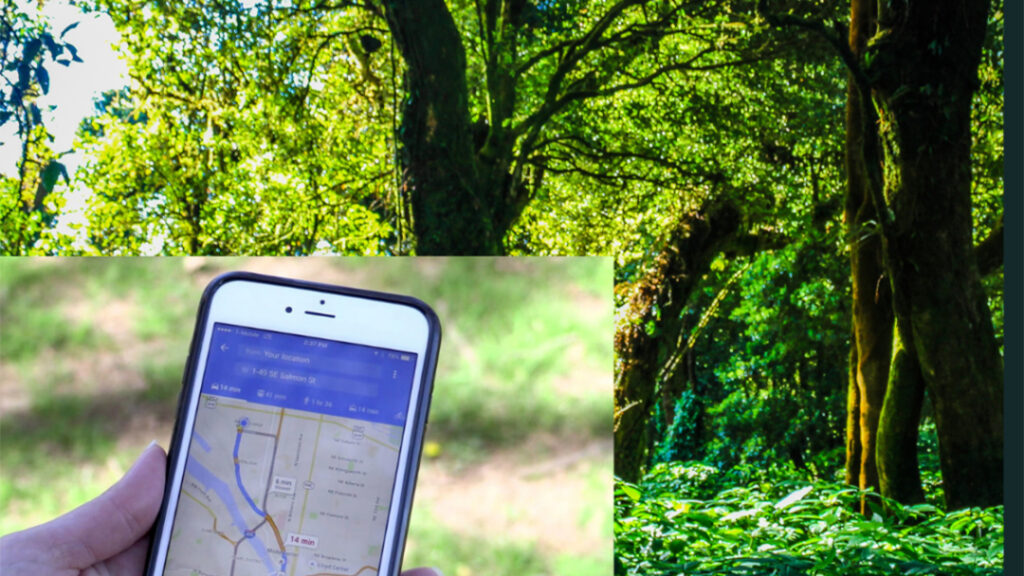
Route Tracking and Management
It is important to note that moving around in forest regions without a guide or means of tracking one’s movement is an easy way to get lost and probably get attacked by wild animals which can be life-threatening. As of June 2020, it is reported that 24 people had been killed by wild animals in Zimbabwe, a record higher than mortality through covid 19 at the time. With the aid of GIS tools like hand-held GPS fitted with imageries and route data, it becomes easy to track one’s movement to safety and this can practically save lives.
Security Set-up to Forestall Encroachment.
There is no gainsaying the fact that our forests need to be protected. While we tend to view this assertion from the surface value only, it is noteworthy that the balance of the natural ecosystem is being maintained through the continued existence of the forests, and as such, there must be security arrangements to protect the forests. The question, however, is how can this be done? GIS, therefore, being a great tool for decision making can help to identify high-risk zones judging from the historic pattern of forest decimation and suggest options for safety to the necessary security operatives. Besides, the live feed made available through the ArcGIS dashboard can be used such that break-ins are captured, and alarms triggered all in a bid to secure the forests.
References:
- https://africanconservation.org/nigeria-bushmeat-hunting-our-wildlife-to-extinction-6/
- https://rainforests.mongabay.com/
Author:
Ubikitan Anuoluwapo Ayomide
Business Development |Sambus Geospatial Nigeria Limited.