Case Study of Kuje Area Council (NEWMAP)
Nigeria Erosion and Watershed Management Project (NEWMAP) aims to mitigate adverse effects of soil and land degradation in the targeted watershed for environmental sustainability in the country. The project aims at tackling severe gully erosion in Southern Nigeria, land degradation in Northern Nigeria, and ecological insecurity on a multi-dimensional scale.
Human society is currently battling soil erosion and degradation as environmental and public health challenges. Statistics show that humans obtain more than 99.7% of their food from the land and less than 0.3% from the oceans and other aquatic ecosystems. This shows the importance that must be attached to soil erosion and degradation issues. Over the years, erosion and other forms of land degradation in southeast Nigeria have affected severe consequences on the people. In the North, the combined forces of flooding and effects of climate change have contributed mainly to deforestation and desertification of people’s livelihood.
Therefore, the emergence of the NEWMAP was in line with Nigeria’s strategic response to the challenges and the emerging land degradation and environmental insecurity.
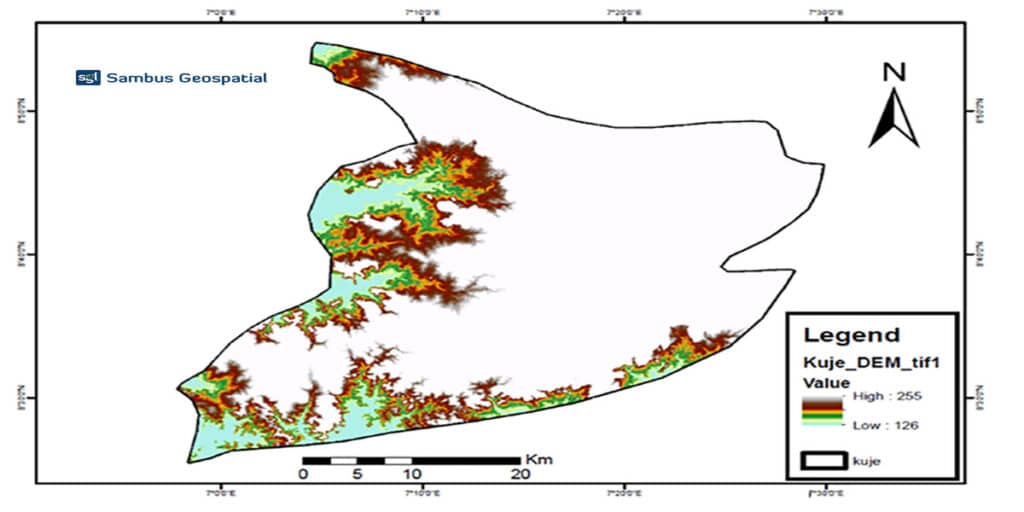
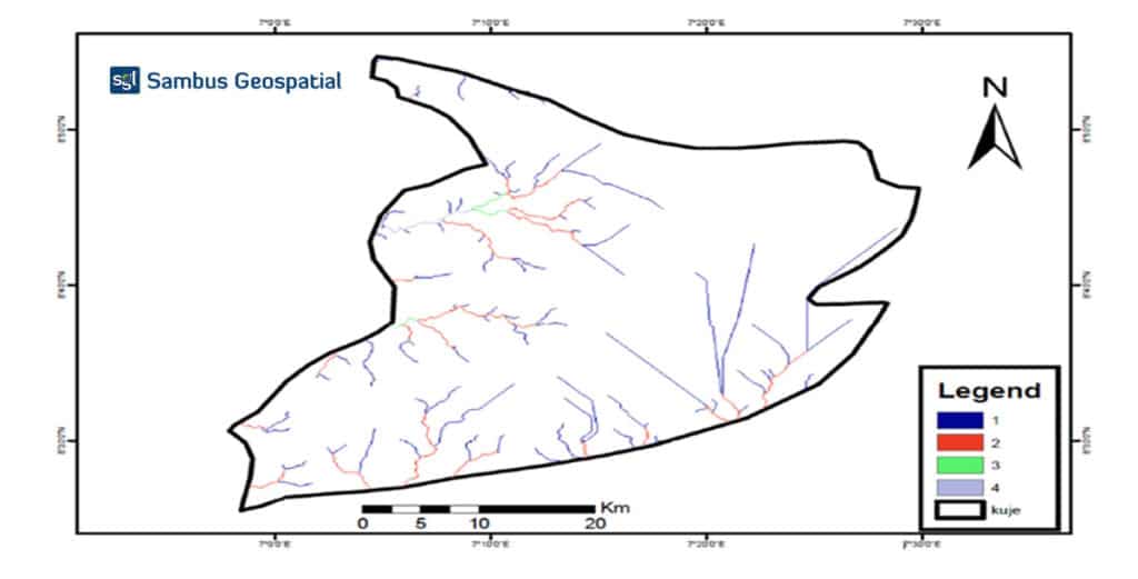
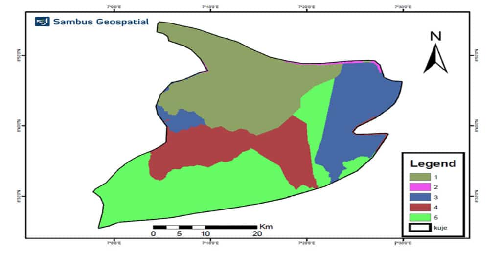
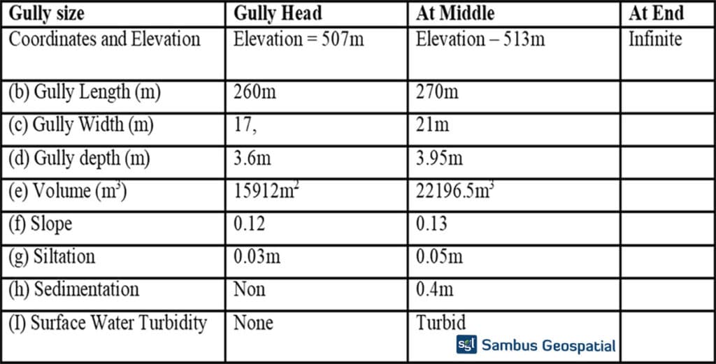
This project seeks to look at the Kuje Area council as a case study to analyze areas with environmental decadence such as gully erosion.
Project by Sambus Geospatial Nigeria
For more information contact Quadri Adebayo – qadebayo@sambusgeospatial.com
SOFTWARE: ArcGIS Desktop 10.8
DATA SOURCES: Glovs, OSGOV: Boundary data, GRID3