Explaining Image Classification in Land Use & Land Cover Studies
Image classification in remote sensing is an essential tool to produce land use and land cover maps. For an image classification process to be successful, factors to be considered include the availability of high-quality Landsat imagery and secondary data, a precise classification process, and the user’s experience and expertise with the procedures.
Types of Image Classification
- Unsupervised Classification
- Supervised Classification
- Object-based Image Analysis
In Image classification types, Supervised classification uses the spectral signatures obtained from training samples to classify an image. Unsupervised classification finds spectral classes (or clusters) in a multiband image without the analyst’s intervention. The Image Classification toolbar aids in unsupervised classification by providing access to the tools to create the clusters, the capabilities to analyze the quality of the clusters, and access to classification tools.
The object-based Image analysis groups neighboring pixels together in terms of similarities that exist between them in a process known as segmentation. In pixels neighborhood grouping decisions for colour and the shape, characteristics are considered in segmentation. It is necessary to Understand image classification in the creation of land use and land cover (LULC).
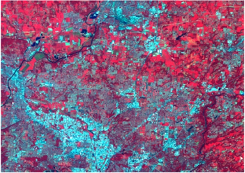
Land Use and Land Cover
Land cover data shows the surface cover on the ground which can be vegetation, built-up area, bare land, wetlands, agriculture, and other land and water types of the cover of a region. Wetlands and open water are classified as different types of water. Land use refers to the purpose the land serves, whether for recreation, development, conservation, or agriculture.
Land Use and Land Cover Relationship
land cover data can be managed and used in a variety of ways. Although Satellite and aerial imagery can be used to give land cover information, it cannot determine land use. Managers make use of Land cover maps to better understand the current landscape. Land cover maps from several years are required to depict temporal changes. Although the terms land cover and land use are frequently used interchangeably, they mean different things.
Global Monitoring as a Change Detection
Global monitoring studies take resource management, and planning activities, identifying, delineating, and mapping land cover as important studies that cannot be neglected. Land cover identification not only helps to establish baselines for monitoring activities (change detection) to be carried out, it also provides ground cover data for baseline thematic maps. Land cover inventory and land use monitoring are beneficial for regional (and state) government agencies’ activities.
Read more here: https://bit.ly/3nFpwwt


Comments are closed.