Problem: Mining for minerals creates large quantities of hazardous waste, called tailings. These are stored in tailings ponds that are retained through the construction of a dam near the mine […]
Prepare for Election Web App Season with these Best Practices
Election Web Apps are in demand. They help the public understand where to vote, report/predict results and tell the story of this unprecedented election. As the Election Web App season […]
Ten ways to get the most out of ArcGIS Living Atlas
Just about all of us use ArcGIS Living Atlas every day. Living Atlas basemaps are the foundation for almost every map or app, whether used in your browser or device. […]
New technical paper explores the key requirements for a comprehensive imagery system
The number of satellites orbiting Earth is growing rapidly; many are used to observe our planet. And satellites are just one way to obtain geospatial imagery—there are also drones, planes, and […]
ArcGIS AllSource is the next generation of intelligence analysis software
Coming March 2023: Explore All Sources of Information with ArcGIS AllSource ArcGIS AllSource is the next generation of intelligence analysis software for intelligence professionals releasing in March. ArcGIS AllSource is […]
GIS DAY 2022 IN NIGERIA AND SAMBUS CONTRIBUTION.
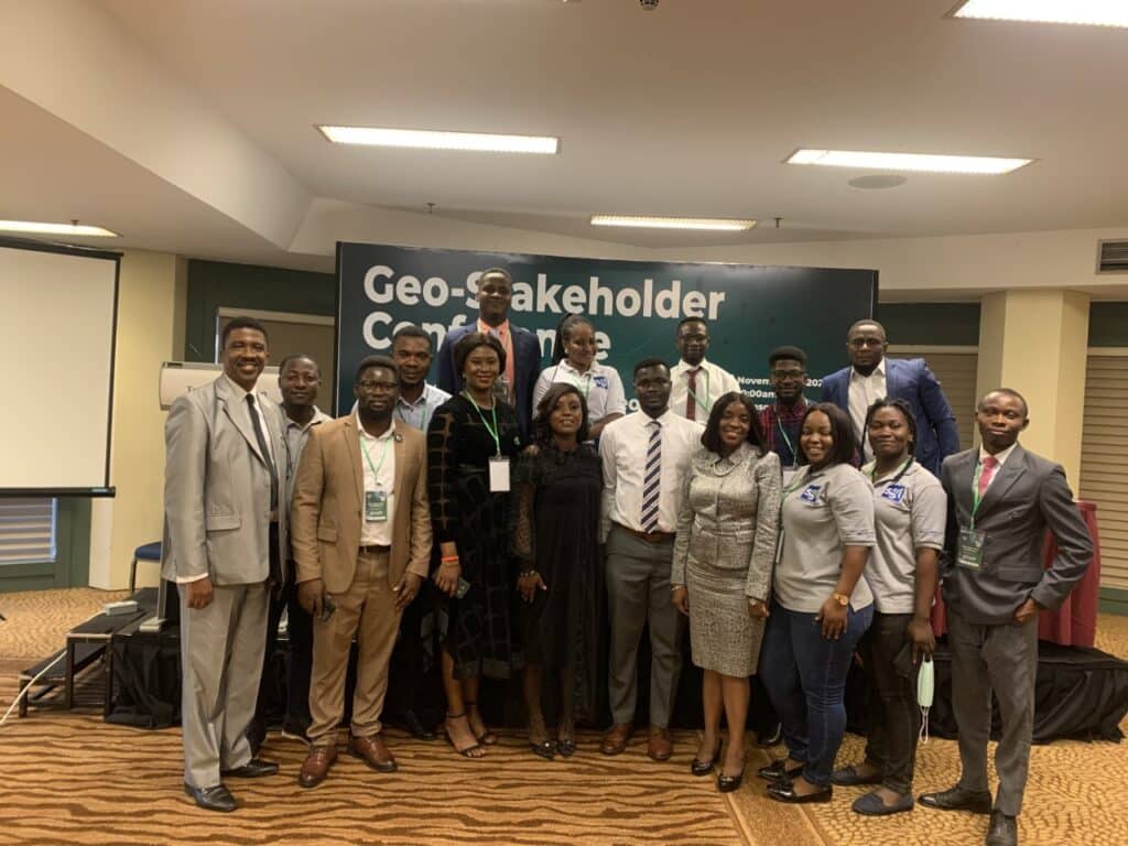
GIS Day is organized yearly 3rd Wednesday of November across the world which Nigeria is not left out. Different sectors registered for the 2022 GIS Day celebration in the nation. […]
GIS and World Cup 2022
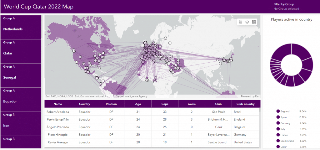
The geographic information system (GIS) is a system that creates, manages, analyzes, and is employed to map world cup data. GIS connects championship data to a map, integrating location data […]
GIS Moves to the Core of Water Infrastructure Framework
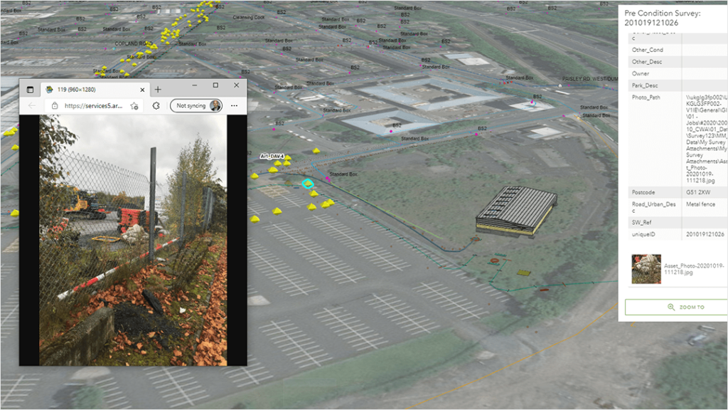
The Caledonia Water Alliance (CWA), formed between AECOM and Morrison Water Services, is supporting the delivery of Scottish Water’s water infrastructure element of its capital investment program. The program’s six-year […]
Drone Mapping in Mozambique Helps Find Flood Victims, with AI Assistance
Since its creation 10 years ago, Space for Giants has grown rapidly, from an academic research project looking into the coexistence of people and elephants to successfully developing a conservation toolkit that […]
Safeguarding Africa’s Protected Areas and Wildlife Using a Holistic Strategy
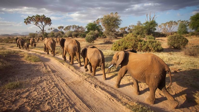
Since its creation 10 years ago, Space for Giants has grown rapidly, from an academic research project looking into the coexistence of people and elephants to successfully developing a conservation toolkit that […]